Boundary Surveys and Land Measurement Services
By Housey · Last reviewed 31st of May 2026
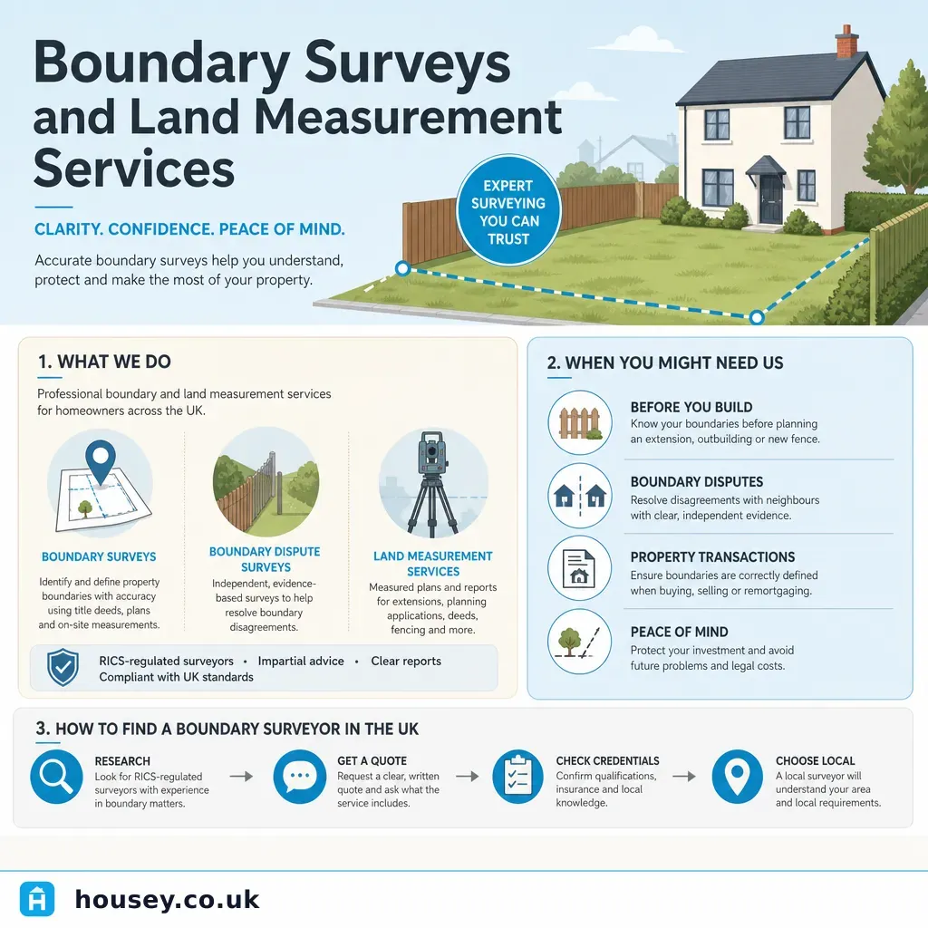
Boundary Surveys and Land Measurement Services
Boundary questions arise most commonly when extending a property, erecting new fencing, resolving a dispute with a neighbour, or preparing a site for development. Title deeds and Land Registry plans are typically drawn at small scales — 1:1250 for urban areas and 1:2500 for rural land — and carry a statutory disclaimer that they show only the general boundary position. That uncertainty means any significant question about where one property ends and another begins usually requires professional measurement and analysis to resolve.
Key points
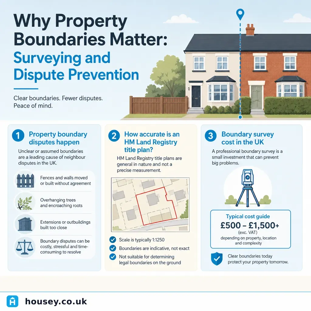
- HM Land Registry title plans are drawn at 1:1250 (urban) or 1:2500 (rural) scale and explicitly indicate only the general boundary position under the Land Registration Act 2002 — they do not fix the legal boundary line.
- A boundary survey by a chartered land surveyor produces a scaled, georeferenced plan and written report that can be used as evidence in legal proceedings or submitted to Land Registry.
- RICS-registered surveyors carrying out boundary work should hold professional indemnity insurance and follow RICS professional standards for boundary surveying practice.
- Fixed boundary determination — formally determining and registering the exact boundary — is a Land Registry process legally separate from a private boundary survey, and requires neighbour agreement or a court order.
- Boundary surveys range from a desktop review of title deeds and historic Ordnance Survey maps to a full on-site measured survey using GPS or total-station equipment.
What is a boundary survey?
A boundary survey establishes where the legal boundary of a property lies by analysing title deeds, conveyancing documents, historic OS maps, physical features on the ground, and (where appropriate) precise on-site measurement. The output is typically a scaled plan accompanied by a written report setting out the surveyor's professional opinion of the boundary position.
Boundary surveys are distinct from RICS home surveys or general building surveys. They are carried out by chartered land surveyors or chartered surveyors with specialist boundary expertise, often RICS-registered.
Types of boundary survey
Type | What it covers | Typical use case |
|---|---|---|
Desktop review | Analysis of title deeds, title plans, and historic maps | Early-stage dispute, low-cost initial assessment |
Measured survey | On-site GPS or total-station measurement with scaled plan | Extensions, new build, site subdivision |
Expert witness report | Formal written opinion for legal proceedings | Boundary disputes proceeding to court or mediation |
Fixed boundary application | Land Registry process to record the exact boundary | Definitive legal certainty binding on future owners |
Why Land Registry title plans do not fix the boundary
HM Land Registry title plans are based on Ordnance Survey mapping and produced under the general boundary rule in the Land Registration Act 2002 and Land Registration Rules 2003. The register indicates the general position of the boundary, not its precise legal line. A boundary shown passing through a hedge, wall, or fence does not specify which side of that feature is the legal boundary.
At ground level, inaccuracies of a metre or more can occur when comparing a title plan with actual physical features. If you are planning works close to a boundary, selling a property where the boundary is contested, or need a precise plan for planning drawings, relying on the title plan alone is usually insufficient.
When do you need a boundary survey?
- Planned extension or development close to a shared boundary, where architects or planners need precise measurements.
- Neighbour dispute over the position of a fence, hedge, wall, or other boundary feature.
- Property sale or purchase where a solicitor has flagged boundary uncertainty as a pre-exchange query.
- Site subdivision or land sale where a new boundary needs to be formally defined and registered.
- Adverse possession claim where the occupation history and boundary position both need to be established.
Decision tree: which type of survey do you need?
- Choose a desktop review first if the uncertainty is recent, documents are accessible, and the disputed area is small — this is the lowest-cost starting point.
- Choose a measured survey if physical positions on the ground are disputed, planning or building control drawings are required, or a desktop review has not resolved the question.
- Commission an expert witness report if the matter is likely to proceed to court or mediation, or if your solicitor recommends it.
- Apply for a fixed boundary determination through Land Registry if you want a permanently recorded legal position binding on future owners — this requires neighbour agreement or a court order.
- Seek solicitor advice alongside the surveyor if there is an active legal dispute, a formal notice has been served, or adverse possession is involved.
Worked UK property scenario
A homeowner in a 1930s semi-detached in the East Midlands wants to build a single-storey rear extension. Their architect needs the boundary plotted precisely for planning drawings, but the existing fence line does not match the position shown on the Land Registry title plan.
The homeowner commissions a chartered land surveyor to carry out a measured survey. The surveyor visits site, takes GPS and total-station measurements, reviews the original conveyance and title documents, and produces a georeferenced plan at 1:200 showing the surveyor's opinion of the boundary. The architect uses this plan to complete the planning drawings. The surveyor's report also notes a possible discrepancy of around 0.4 m in one corner and recommends the homeowner's solicitor write to the neighbour to agree the position formally before the extension is built.
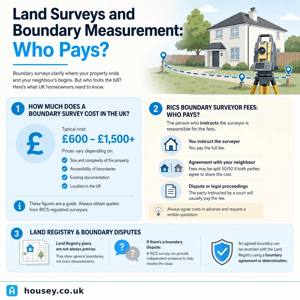
Indicative cost for a measured boundary survey on a standard residential plot: typically £500–£1,500 plus VAT, depending on plot size, complexity, and location. Indicative UK costs, last reviewed 2026-05-31. Obtain at least two or three quotes from RICS-registered surveyors.
What to ask a boundary surveyor before instructing
- What type of survey do you recommend for my situation, and why?
- Are you a RICS-registered chartered surveyor with specific boundary surveying experience?
- What documents should I gather before you start work?
- Will your report be suitable as evidence in legal proceedings if needed?
- What does the fee include — site visit, scaled plan, georeferenced data, and written report?
- How long will the survey take, and when will I receive the final report?
- Do you hold current professional indemnity insurance?
- Is VAT included in the quoted fee?
When to get professional help
If a boundary dispute has been put in writing by a solicitor or involves formal legal proceedings, you need both a qualified boundary surveyor and a solicitor. Seek professional help promptly if:
- A neighbour has served a formal notice or instructed a solicitor regarding the boundary.
- You plan works that may encroach on a neighbour's land, even by a small margin.
- A buyer's solicitor has raised a boundary query as a pre-exchange condition.
- You suspect adverse possession is involved on either side.
- The boundary question also involves a party wall matter.
Do not rely on a verbal agreement between neighbours or on the title plan alone — both have limited legal weight without a formal recorded agreement.
How Housey can help
Housey connects homeowners with verified boundary surveyors across the UK. Submit a single request describing your boundary question and receive quotes from RICS-registered professionals who can advise whether a desktop review, measured survey, or expert witness report is the right approach for your situation.
Frequently asked questions
How accurate is a boundary survey?
A measured survey using GPS or total-station equipment can locate physical features to within a few centimetres. However, the legal boundary position is a matter of interpreting title deeds and documents, not just measurement. A surveyor's report gives a professional opinion of where the boundary lies, which may differ from another surveyor's view if documents are ambiguous.
Can a boundary survey resolve a dispute with my neighbour?
A surveyor's report provides strong evidence of the boundary position but cannot compel a neighbour to accept it. If both parties obtain conflicting reports, the matter may need to proceed to mediation or court. A boundary formally agreed and recorded with Land Registry is binding on future owners and provides lasting certainty.
Do I need a solicitor as well as a boundary surveyor?
In most dispute situations, yes. The solicitor advises on your legal rights and options; the surveyor provides the technical boundary evidence. For a straightforward pre-development measurement with no dispute, a solicitor may not be needed immediately, but seek legal advice if there is any ambiguity about the boundary position or your rights.
How long does a boundary survey take?
A desktop review may be completed within a few days. A measured survey with a full written report typically takes one to three weeks from instruction, depending on surveyor availability, plot complexity, and document retrieval times. Fixed boundary applications to Land Registry involve neighbour agreement processes and can take considerably longer.
Sources and further reading
- Land Registration Act 2002 — legislation.gov.uk
- Your property boundaries — GOV.UK
- HM Land Registry — HM Land Registry
- RICS professional standards — RICS
Useful next reads
 Surveys & Inspections
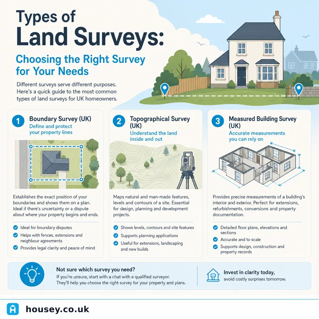
Types of Land Surveys: Choosing the Right Survey for Your Needs
UK land surveys fall into distinct types: topographical surveys map terrain and features for planning and design; measured building surveys record existing structures for extension or conversion work; boundary surveys establish legal property limits; and ground investigation surveys assess soil and foundation conditions.
 Surveys & Inspections
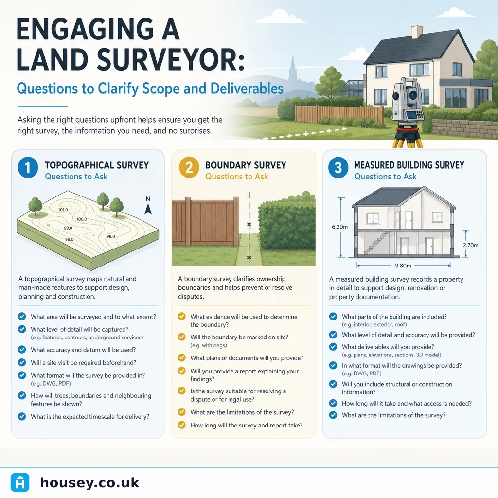
Engaging a Land Surveyor: Questions to Clarify Scope and Deliverables
When engaging a land surveyor, clarify exactly which type of survey you need — topographical, boundary, or measured building — before agreeing a fee.
 Surveys & Inspections
Land Surveys and Boundary Measurement: Who Pays
There is no statutory rule in England and Wales that determines who pays for a boundary or land survey.
 Surveys & Inspections
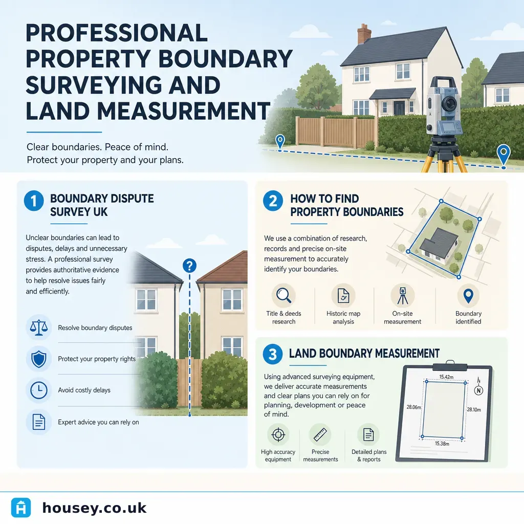
Professional Property Boundary Surveying and Land Measurement
A property boundary survey precisely establishes the legal extent of your land using title deeds, Ordnance Survey data, and physical evidence.
 Surveys & Inspections
Why Property Boundaries Matter: Surveying and Dispute Prevention
Property boundaries in England and Wales are recorded as general boundaries by HM Land Registry — not precise measurements.