Engaging a Land Surveyor: Questions to Clarify Scope and Deliverables
By Housey · Last reviewed 7th of May 2026
Engaging a Land Surveyor: Questions to Clarify Scope and Deliverables
Whether you are preparing a planning application, resolving a boundary dispute, or commissioning drawings for an extension, engaging a land surveyor at the outset can prevent costly errors and legal complications. The challenge is that 'land surveyor' covers several distinct disciplines — each producing different outputs, to different accuracy standards, for different purposes — and agreeing scope in writing before fieldwork begins is the single most effective way to avoid disputes over deliverables.
Key points
- 'Land surveyor' is not a protected title in the UK; always verify that your surveyor holds relevant professional membership such as RICS (Royal Institution of Chartered Surveyors) or CICES (Chartered Institution of Civil Engineering Surveyors) before instructing them.
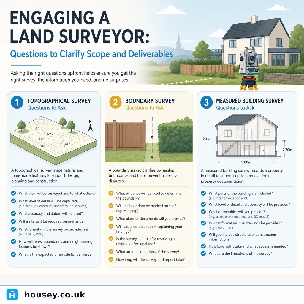
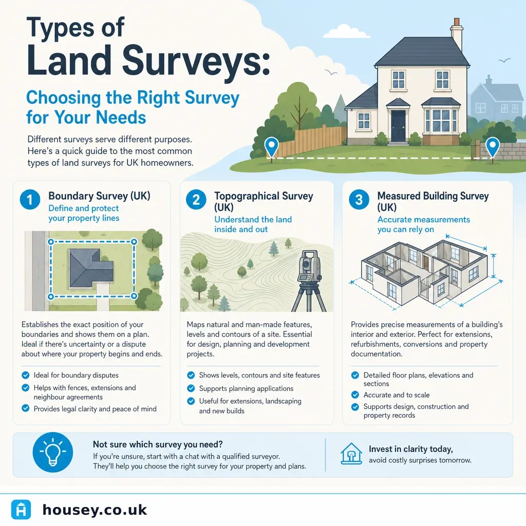
- Topographical surveys and boundary surveys produce entirely different outputs: a topographical survey captures ground levels, features, and contours; a boundary survey determines the legal extent of land ownership.
- Accuracy is defined by tolerances — such as ±50 mm for a residential topographical survey or ±5 mm for a measured building survey — and must be agreed in writing before fieldwork.
- Deliverables vary significantly: AutoCAD DWG files, georeferenced PDFs, OS National Grid-referenced point clouds, or written boundary reports, depending on the survey type and your intended use.
- If a boundary dispute may involve legal proceedings, you need an RICS-accredited expert witness or specialist boundary surveyor, not a general land surveyor's report.
What type of land survey do you need?
Before asking about fees, be clear about what you are trying to achieve. Describe your objective to prospective surveyors and ask them to confirm which survey type is appropriate.
Survey type | What it captures | Typical output | Common use |
|---|---|---|---|
Topographical survey | Ground levels, features, trees, structures, utilities | AutoCAD DWG or georeferenced PDF | Planning applications, drainage design, extension design |
Measured building survey | Internal and external dimensions of existing structures | Floor plans, elevations, sections in CAD | Renovation drawings, listed building submissions |
Boundary survey | Legal extent of title, physical boundaries, encroachments | Written report and annotated title plan | Disputes, pre-purchase due diligence, land registration |
Setting-out survey | Positioning of new structures to design coordinates | Site marks plus verification record | New build, extensions, infrastructure |
Arboricultural survey | Tree species, condition, root protection zones | Report and constraints plan per BS 5837 | Planning near trees, development constraints |
Key questions to ask before commissioning
Qualifications and insurance
- Are you a member of RICS, CICES, or another recognised professional body, and can you confirm your membership number?
- Do you hold professional indemnity insurance, and what is the level of cover?
- If this survey may be used in a boundary dispute, do you have experience acting as an expert witness?
Scope and methodology
- What is explicitly included in the scope, and what is explicitly excluded?
- What accuracy tolerance will the survey be produced to, and how is it verified?
- Will you use GPS/GNSS, total station, or terrestrial laser scanning — and does the method suit my site conditions (dense vegetation, underground utilities, restricted access)?
- Will the data be tied to Ordnance Survey National Grid coordinates, and at what accuracy level?
Deliverables
- What file formats will I receive — DWG, PDF, IFC, LAS point cloud — and are they compatible with what my architect or engineer requires?
- Will drawings include a title block, north point, scale bar, and datum reference?
- Will I receive a methodology statement describing equipment used and accuracy achieved?
- For boundary surveys: will I receive a written interpretive report, not just a marked-up plan?
Timeline and fees
- Is VAT included in the quotation?
- What would trigger additional costs — inaccessible areas, extra detail, or neighbouring landowner access requirements?
- When will I receive the final deliverable, and what is the procedure if unexpected features are found?
Topographical vs boundary survey: which do you need?
- Choose a topographical survey if you are applying for planning permission, designing drainage or landscaping, or need an accurate record of levels and features for design purposes.
- Choose a boundary survey if you believe a neighbour has encroached, you are purchasing land and want to verify the title plan, or you need to register previously unregistered land.
- Commission both separately if you need both — a topographical surveyor may plot visible boundary features, but this does not constitute a legal boundary determination.
- Ask a solicitor first if legal proceedings are possible or have already begun before instructing any surveyor.
Deliverables checklist: what you should receive
Confirm the following before fieldwork begins:
Red flags when selecting a land surveyor
- No verifiable professional body membership and no evidence of professional indemnity insurance.
- A quotation that does not specify the coordinate system, accuracy tolerance, or deliverable file formats.
- Refusal to provide a written scope of works before starting fieldwork.
- For boundary surveys: no explanation of how title deeds, conveyances, and physical features will be analysed and weighted.
- Deliverables described only as 'a plan' with no agreed scale, format, or content.
- Fees significantly below other quotations with no explanation of what has been excluded.
When to get professional help
Always use a qualified and insured land surveyor for any survey submitted to a planning authority, building control body, or structural engineer, and for any boundary matter where legal proceedings are possible. If a boundary dispute escalates, the court will require expert witness evidence from a suitably qualified RICS-accredited surveyor — using an unaccredited practitioner early can undermine your position later.
Seek solicitor advice if:
- A neighbour has built or is building across what you believe to be your legal boundary.
- HM Land Registry title plans are ambiguous or conflicting between adjacent titles.
- You are purchasing land where physical boundaries do not correspond clearly to the title plan.
How Housey can help
Housey makes it straightforward to request quotes from qualified UK land surveyors. Whether you need a topographical survey for a planning application, a measured building survey for a renovation or extension, or a boundary surveyor to resolve a dispute or verify your title, you can compare quotes from vetted professionals through Housey.
Frequently asked questions
Is 'land surveyor' a protected title in the UK?
No. Unlike 'chartered surveyor' (a protected designation under RICS), 'land surveyor' is not legally protected and anyone can use it. Always verify professional memberships — MRICS, FRICS, or MCICES — and confirm professional indemnity insurance before instructing anyone for planning, design, or legally sensitive work.
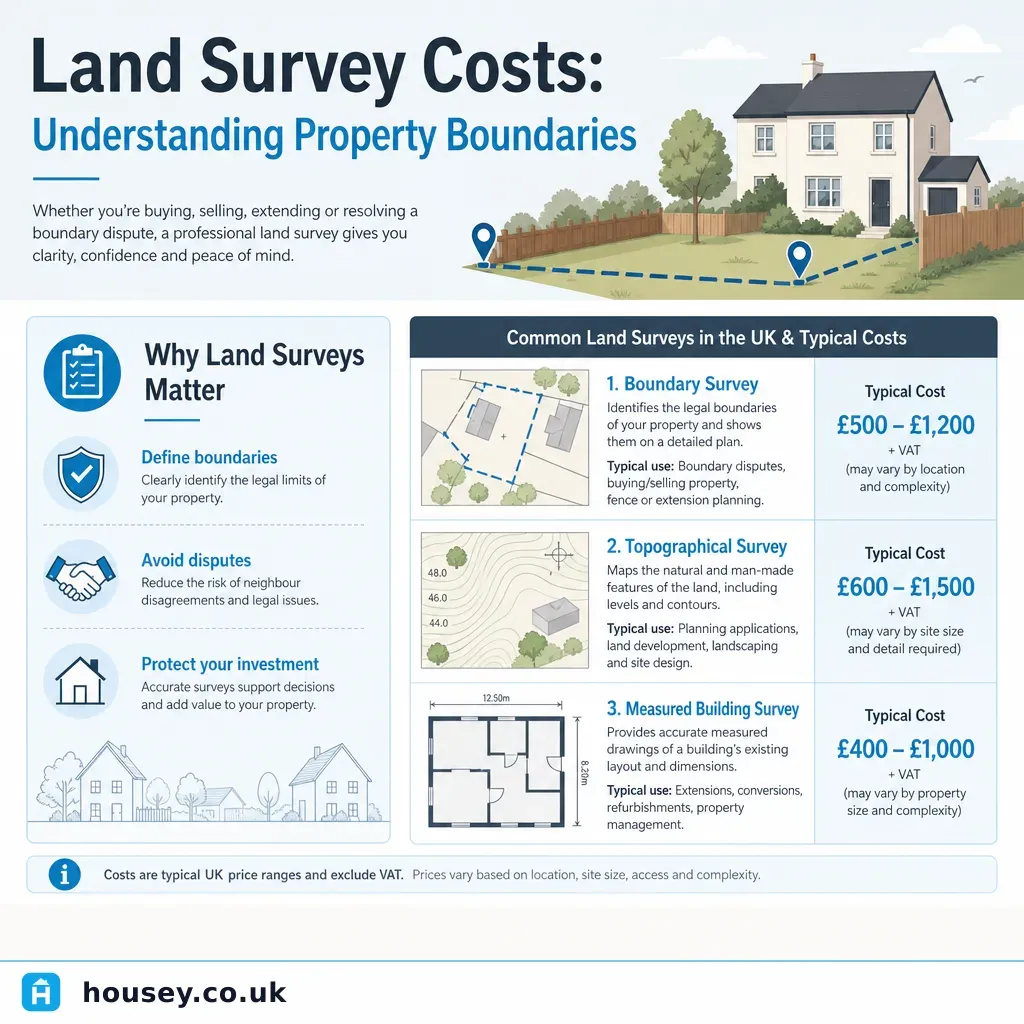
How much does a topographical survey cost in the UK?
Costs vary significantly by site size, complexity, and detail required. Indicative UK costs, last reviewed 2026-05-07: a residential plot may cost £600–£1,500; a larger development site or complex urban plot can cost £2,000–£5,000 or more. Request itemised quotes from at least three surveyors and confirm accuracy standard, coordinate system, and file formats are included. Costs vary; obtain current quotes.
What is the difference between a topographical survey and an OS map?
An Ordnance Survey map is a generalised national product, typically accurate to ±1 m or more. A site-specific topographical survey is carried out on your plot to a defined tolerance — often ±50 mm for residential work — and captures features OS mapping omits, such as drainage gullies, tree positions, retaining walls, and ground levels at close intervals.
Do I need a topographical survey for a planning application?
Not always, but many local planning authorities request one for applications involving significant earthworks, drainage design, or sloping sites. Check your local planning authority's validation checklist before submitting. Architects and engineers almost always need a topographical survey to produce accurate design drawings for extensions or new builds on ground with any level change.
Can a boundary survey resolve a legal dispute with my neighbour?
A boundary survey provides expert evidence about the probable position of the legal boundary, but cannot by itself resolve a dispute if the other party rejects the findings. Contested cases may need to progress through HM Land Registry's boundary determination process or the courts. Early solicitor involvement is advisable whenever a boundary dispute is contentious or escalating.
Sources and further reading
- RICS professional guidance on land and boundaries — RICS
- Land Registry plans — the basis of Land Registry services — HM Land Registry
- Making a planning application — required documents — GOV.UK Planning Portal
- Chartered Institution of Civil Engineering Surveyors — CICES
- Find a regulated RICS surveyor — RICS
Useful next reads
 Surveys & Inspections
Land Survey Costs: Understanding Property Boundaries
Land survey costs in the UK depend on the type of survey needed: boundary surveys typically cost £500–£2,000, topographical surveys £600–£2,500, and measured building surveys £800–£3,000 for a standard house.
 Surveys & Inspections
Professional Property Boundary Surveying and Land Measurement
A property boundary survey precisely establishes the legal extent of your land using title deeds, Ordnance Survey data, and physical evidence.
 Surveys & Inspections
Understanding Property Boundaries and Party Wall Agreements
Property boundaries define the legal extent of your land; the Party Wall etc.
 Surveys & Inspections
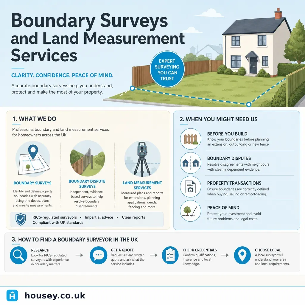
Boundary Surveys and Land Measurement Services
A boundary survey establishes where the legal boundary of a property sits, using title deeds, historic maps, and on-site measurement.
 Surveys & Inspections
Types of Land Surveys: Choosing the Right Survey for Your Needs
UK land surveys fall into distinct types: topographical surveys map terrain and features for planning and design; measured building surveys record existing structures for extension or conversion work; boundary surveys establish legal property limits; and ground investigation surveys assess soil and foundation conditions.