Why Property Boundaries Matter: Surveying and Dispute Prevention
By Housey · Last reviewed 19th of May 2026
Why Property Boundaries Matter: Surveying and Dispute Prevention
Property boundaries define exactly where your land ends and your neighbour's begins — yet in England and Wales, even a registered title plan does not give you a precise legal measurement. Questions about where a boundary actually falls most often arise when planning building work, erecting a fence, buying a property with an ambiguous title plan, or when a neighbour challenges your use of a strip of land. Getting it wrong can delay projects, void planning permissions, and lead to costly legal proceedings.
Key points
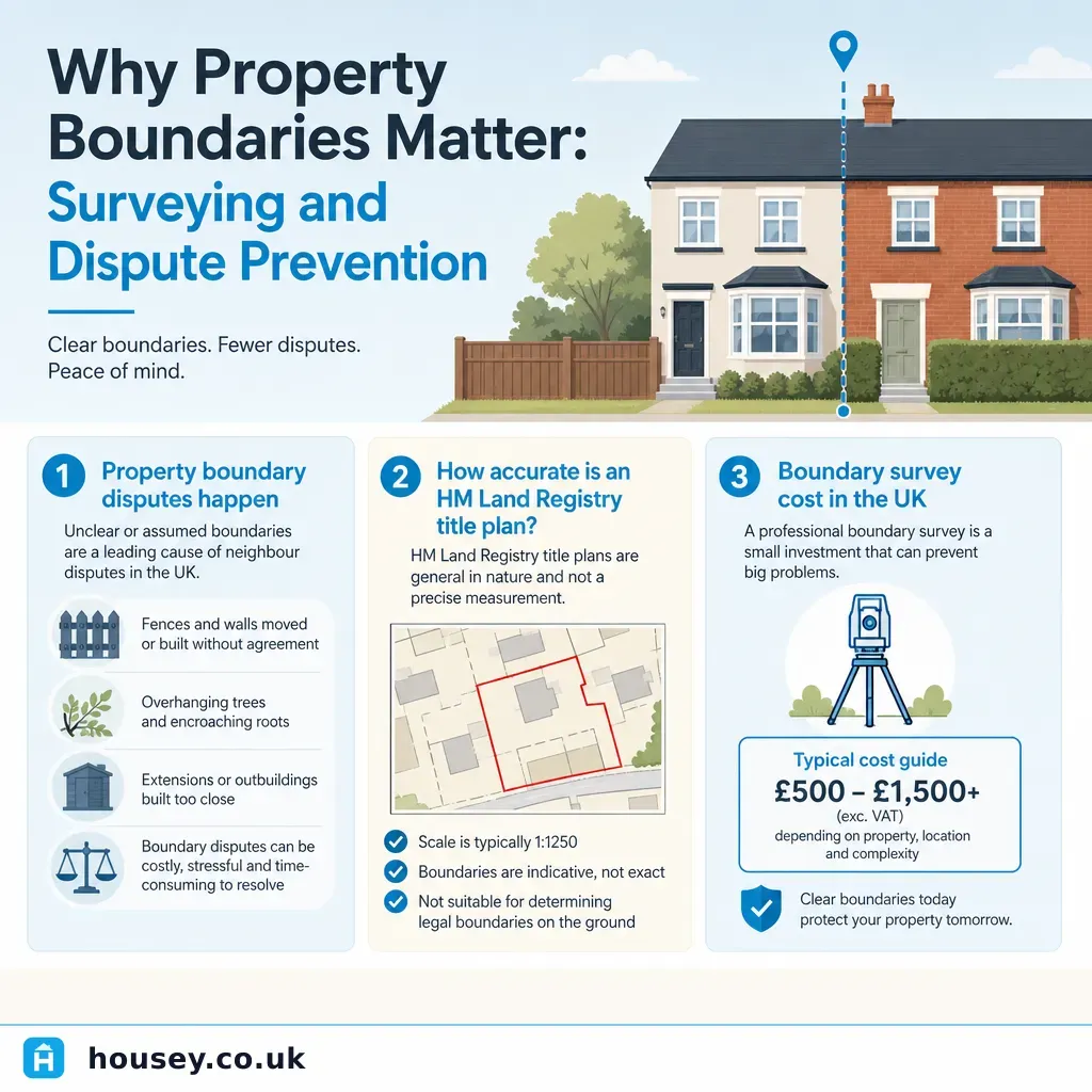
- HM Land Registry title plans are drawn at 1:1250 or 1:2500 scale and show general boundaries only — they do not establish precise ownership to the centimetre.
- The general boundary rule (Land Registration Act 2002, s.60) means the registered boundary is approximate until a formal determined boundary application is made.
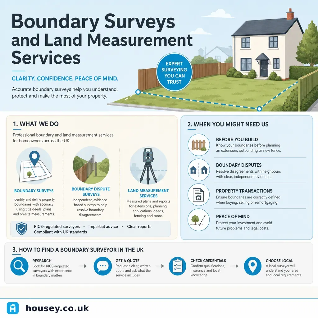
- A measured boundary survey by a Chartered Land Surveyor maps the physical extent of the land against the title plan and is the standard evidence used in boundary disputes.
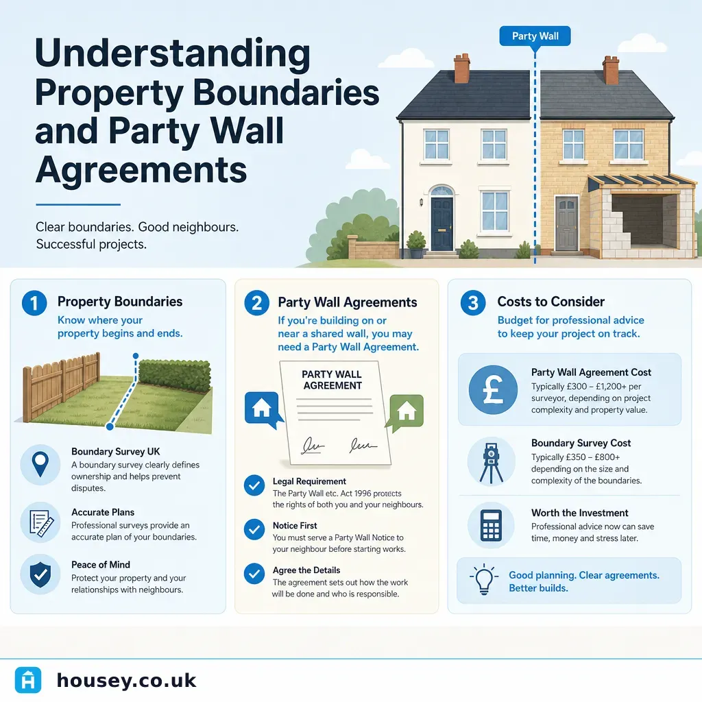
- Party wall matters require a separate legal process under the Party Wall etc. Act 1996, distinct from a boundary survey.
- Adverse possession claims for registered land require 10 years of open, continuous use under schedule 6 of the Land Registration Act 2002.
What a property boundary actually is
In England and Wales, HM Land Registry records ownership using title plans derived from Ordnance Survey maps. These plans show a general boundary — a red line indicating roughly where the boundary lies — but the Land Registration Act 2002 (section 60) formally confirms this is approximate, not a precise legal measurement.
This matters in practice because:
- A line of normal pen width on a 1:1250 plan can represent roughly 0.5–1 metre on the ground.
- Title plans do not always account for physical features such as old walls, hedges, or fences that have shifted over decades.
- The ownership of boundary features — which party owns the wall, fence, or hedge — is not shown on the title plan; you need to check the title deeds and any retained conveyancing documents.
A Chartered Land Surveyor (a member of RICS or the Chartered Institution of Civil Engineering Surveyors) can produce a measured boundary survey that maps the physical extent of the land against the title plan, identifying discrepancies and providing scaled drawings that can be used as evidence.
When accurate boundary information matters most
Boundaries are usually not an issue until something changes. Common trigger points include:
- Planning an extension or outbuilding — building control and planning applications require accurate site measurements. Encroachment onto a neighbour's land can invalidate planning permission and require costly demolition or alteration.
- Erecting a fence or wall — disputes frequently arise from fence placement. A boundary survey before work starts is far cheaper than retrospective legal proceedings.
- Buying or selling a property — if the title plan is ambiguous, buyers' solicitors may raise boundary requisitions that need a surveyor's input to resolve before exchange of contracts.
- Neighbour disputes — where a neighbour challenges your use of land, a professional measured survey provides independent evidence to support or challenge that position.
- Adverse possession — if land has been openly and continuously used for 10 years (registered land under the Land Registration Act 2002) or 12 years (unregistered land under the Limitation Act 1980), an adverse possession claim may arise.
Decision tree: do you need a boundary survey?
- Use a standard title search if you are buying a conventional property with no obvious boundary ambiguity and your solicitor is satisfied with the title plan.
- Instruct a boundary surveyor if you are planning works close to a boundary, if a neighbour has raised a dispute, or if the title plan shows an anomaly that needs clarifying before exchange.
- Instruct a party wall surveyor (under the Party Wall etc. Act 1996) if your proposed works involve a shared wall or are within 3–6 metres of a neighbour's foundations — this is a separate legal process from boundary surveying.
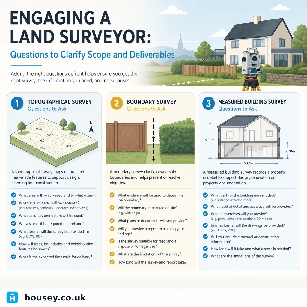
- Consider a topographical survey if you need accurate ground-level measurements for a planning application or extension design — this covers levels, features, and dimensions in addition to boundary positions.
- Consider a determined boundary application to HM Land Registry if you need the legal boundary fixed permanently on the register after a resolved dispute — this requires a licensed conveyancer or solicitor and a surveyor's report.
- Seek legal advice if a neighbour has erected a structure you believe encroaches on your land — early mediation is usually far cheaper than court proceedings.
What to expect from a boundary survey
A Chartered Land Surveyor will typically:
- Study the title plan, title deeds, transfer plans, and any historical documents.
- Visit the site to measure physical features and compare them against the Ordnance Survey base.
- Identify discrepancies between what the plan shows and what exists on the ground.
- Produce a scaled survey drawing and a written report explaining the findings.
- Where a dispute exists, prepare a report capable of being used in mediation, expert determination, or legal proceedings.
Costs vary significantly by property size, complexity, and location. Indicative UK costs, last reviewed 2026-05-19: simple residential boundary surveys often start from around £500–£1,500, but complex disputed cases can cost considerably more. Always obtain at least two or three written quotes and verify the surveyor's RICS membership independently.
Comparison table: boundary-related professional services
Service | What it covers | Best for | Not ideal for |
|---|---|---|---|
Boundary survey | Measured mapping of physical boundaries against the title plan | Planning extensions, pre-purchase ambiguity, dispute evidence | Ongoing legal proceedings without a specialist report |
Topographical survey | Detailed mapping of land levels, features, and dimensions | Extension or new-build design, planning applications | Pure boundary ownership questions |
Party wall survey | Service under the Party Wall etc. Act 1996 for shared walls and excavations | Works to shared structures or within 3–6 m of neighbour's foundations | Confirming ownership of land |
Expert determination | Binding expert opinion in a boundary dispute | Avoiding court where both parties agree to the process | Cases where one party refuses to participate |
HM Land Registry determined boundary | Formal legal fixing of the boundary on the register | Long-term certainty after a resolved dispute | Quick or low-cost resolution |
What not to assume about property boundaries
"The fence is the boundary." A fence's position reflects where someone chose to put it — not necessarily the legal line. Old fences shift, get rebuilt, or were never correctly placed in the first place.
"If it's on my title plan, it's mine." The general boundary rule means the plan is indicative. Physical measurement may tell a different story.
"My neighbour's survey proves they're right." A survey commissioned by one party is useful evidence but is not automatically binding. An independent survey, or a single jointly instructed expert, is usually more persuasive in disputes.
"I can claim land I've been using for years." Adverse possession claims for registered land require meeting specific tests under the Land Registration Act 2002 — including 10 years of factual possession. Seek legal advice before acting, as the process is not straightforward.
When to get professional help
Consult a Chartered Land Surveyor or solicitor promptly if:
- A neighbour has erected a structure you believe is on your land.
- You are about to start building work close to a boundary and are unsure of its precise location.
- You have received a formal boundary dispute notice or a pre-action letter.
- A title plan ambiguity is delaying exchange of contracts.
- You are considering or defending an adverse possession claim.
Early professional advice is almost always significantly cheaper than escalated legal proceedings.
How Housey can help
Housey connects you with qualified boundary surveyors and party wall surveyors who can assess your site and prepare independent, professionally prepared reports. If your project also requires a topographical survey for planning or design purposes, Housey can match you with accredited local surveyors.
Frequently asked questions
How accurate is an HM Land Registry title plan?
Title plans are drawn at 1:1250 (urban) or 1:2500 (rural) scale. At these scales, even a thin line can represent 0.5–1 metre on the ground. They show general boundaries — enough to identify the property, but not precise enough to resolve centimetre-level boundary questions. A measured boundary survey by a Chartered Land Surveyor is needed for precision.
Can a boundary dispute be resolved without going to court?
Yes, most boundary disputes are resolved without litigation. Mediation, expert determination (where both parties appoint a single independent expert), and solicitor-negotiated agreements are all well-established routes. Boundary disputes that reach court can cost tens of thousands of pounds; early professional surveying and mediation are significantly cheaper.
Does a boundary survey change my title register?
A standard boundary survey does not automatically alter your title register. However, if you wish to fix the legal boundary permanently, the findings can support a determined boundary application to HM Land Registry under the Land Registration Act 2002. This is a formal process requiring a conveyancer and surveyor working together on the application.
Do I need both a boundary survey and a party wall survey?
Possibly. A boundary survey establishes where the legal boundary lies. A party wall survey (under the Party Wall etc. Act 1996) is a separate legal process required when works involve a shared wall or excavation within 3–6 metres of a neighbour's foundations. For extension projects close to a boundary, you may need both.
Sources and further reading
- Land Registration Act 2002 — general boundary rule (s.60) — legislation.gov.uk
- HM Land Registry Practice Guide 40: Land Registration and Boundaries — GOV.UK
- Party Wall etc. Act 1996 — legislation.gov.uk
- RICS: Boundaries, Party Walls and Neighbourly Matters — RICS
Useful next reads
 Surveys & Inspections
Understanding Property Boundaries and Party Wall Agreements
Property boundaries define the legal extent of your land; the Party Wall etc.
 Surveys & Inspections
Boundary Surveys and Land Measurement Services
A boundary survey establishes where the legal boundary of a property sits, using title deeds, historic maps, and on-site measurement.
 Surveys & Inspections
Engaging a Land Surveyor: Questions to Clarify Scope and Deliverables
When engaging a land surveyor, clarify exactly which type of survey you need — topographical, boundary, or measured building — before agreeing a fee.
 Surveys & Inspections
Managing Shared Driveway Rights and Responsibilities
A shared driveway is usually governed by an easement or express right recorded in your title deeds.
 Surveys & Inspections
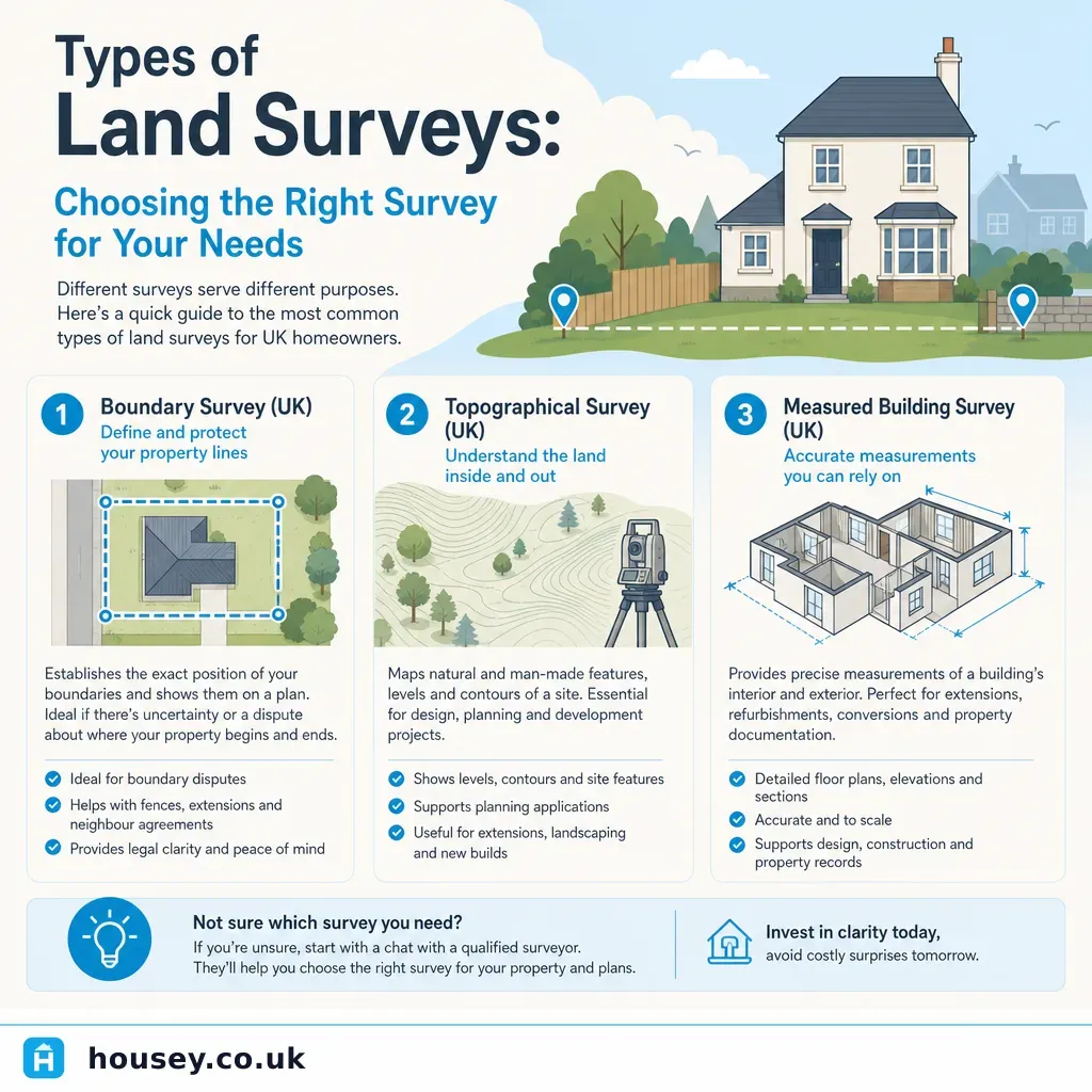
Types of Land Surveys: Choosing the Right Survey for Your Needs
UK land surveys fall into distinct types: topographical surveys map terrain and features for planning and design; measured building surveys record existing structures for extension or conversion work; boundary surveys establish legal property limits; and ground investigation surveys assess soil and foundation conditions.