Land Surveys and Boundary Measurement: Who Pays
By Housey · Last reviewed 31st of May 2026
Land Surveys and Boundary Measurement: Who Pays
Boundary and land survey fees sit in an awkward gap in UK property transactions and disputes — costs can escalate quickly if a disagreement reaches the First-tier Tribunal (Property Chamber) or the courts. Whether you are buying a property with an unclear boundary, trying to sell without a definitive title plan, or in a disagreement with a neighbour, knowing who typically bears survey costs and why matters long before you instruct a professional.
Key points
- HM Land Registry title plans are drawn to a "general boundary rule" and are not definitive for precise boundary positions — a separate measured survey is needed for legal accuracy.
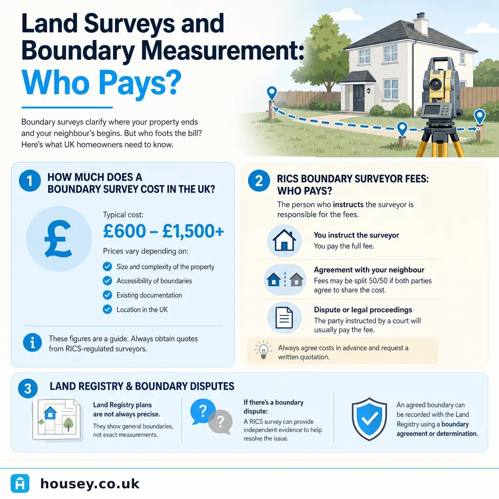
- A RICS-accredited boundary surveyor's determination report typically costs £600–£2,500 for a residential boundary, rising significantly for expert witness work (indicative UK costs, last reviewed 2026-05-31).
- In a boundary dispute, each party usually pays for their own surveyor; there is no obligation on either side to share costs unless agreed or ordered by a tribunal.
- The Land Registration Act 2002 provides a mechanism to apply for a determined boundary at HM Land Registry, which fixes the legal boundary permanently on the register.
- HM Land Registry title register documents (title plan and register entries) can currently be obtained online for £3 per document — a sensible first step before instructing any surveyor.
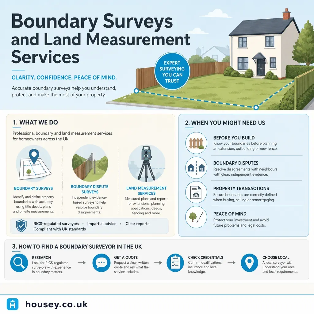
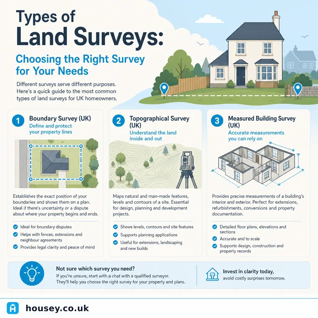
What type of survey measures boundaries?
Several survey types may be relevant to land and boundary measurement, and it is easy to instruct the wrong one:
Survey type | What it covers | Typical professional | When you need it |
|---|---|---|---|
Boundary determination report | Legal position of a boundary, using title deeds, historic maps, and physical features | RICS-accredited boundary surveyor | Boundary dispute; buying land; selling where boundary is unclear |
Topographic survey | Physical features of a site — levels, structures, trees, drainage | Land surveyor or geomatics engineer | Planning applications, development appraisals, engineering design |
Measured building survey | Floor plans and elevations of an existing structure | Architect or building surveyor | Renovation design, planning submissions, lease plans |
RICS Level 2 or Level 3 Home Survey | Condition of a property — not boundary positions | RICS-accredited building surveyor | Buying a residential property |
Lease plan | Layout of a leasehold property for registration purposes | Solicitor-instructed surveyor | Leasehold flat purchase or first registration at HM Land Registry |
A boundary determination report is the survey most relevant to boundary disputes and measurement questions. A topographic survey records physical features but does not resolve the legal boundary position.
Who pays for a boundary survey in the UK?
On a property purchase
The buyer pays for any surveys they commission. If a conveyancer identifies a boundary irregularity that requires a measured survey, the buyer typically bears this cost. Where the ambiguity arises from a seller-side issue — such as an encroachment or missing deeds — it may be possible to negotiate a price reduction or ask the seller to resolve the discrepancy before exchange. This should be handled through solicitors.
In a boundary dispute
Each party usually commissions and pays for their own surveyor. If the dispute reaches the First-tier Tribunal (Property Chamber) or the courts, costs orders can be made — but these are not guaranteed and litigation is expensive. Joint instruction of a single agreed expert is possible and can reduce cost, but requires both parties to agree on the scope of instructions before work begins.
On a new build or development
The developer typically bears the cost of surveys needed to establish plot boundaries before registration at HM Land Registry. Buyers receive the registered title plan on completion. That plan is indicative — buyers who need certainty about a boundary close to a fence, wall, or access route should raise this with their solicitor before exchange.
Checklist: what to establish before commissioning a boundary survey
How much does a boundary or land survey cost?
Indicative UK costs, last reviewed 2026-05-31:
- HM Land Registry title register and plan: £3 per document, online.
- Boundary determination report (RICS surveyor): £600–£2,500 for a standard residential boundary; higher for complex cases or agricultural land with long or irregular boundaries.
- Joint single-expert instruction: may reduce individual exposure; typically £800–£1,800 in total for a straightforward residential case.
- Expert witness report (for tribunal or court use): £2,000–£5,000 or more, depending on complexity, preparation time, and attendance at hearings.
- Topographic survey: £800–£3,000 depending on site area and specification.
These figures vary significantly by location, surveyor, and complexity. Always request a detailed written quote itemising scope, deliverables, and any assumptions that could change the price.
When to get professional help
Always instruct a qualified professional if:
- A boundary dispute is threatening your relationship with a neighbour or preventing a sale.
- You are receiving legal correspondence about a boundary, encroachment, or adverse possession claim.
- A buyer or their solicitor is raising boundary queries that your title deeds cannot resolve.
- You are applying to HM Land Registry for a determined boundary.
- You are building close to a boundary and need to establish the precise line before work begins.
- Your conveyancer has flagged an encroachment or title defect that the seller is not resolving.
How Housey can help
Housey can connect you with RICS-accredited boundary surveyors who can review your title deeds, carry out a measured survey, and produce a boundary determination report suitable for HM Land Registry applications or use in dispute resolution proceedings.
Frequently asked questions
Does HM Land Registry decide where my boundary is?
HM Land Registry records the general boundary of your property based on the title plan, typically drawn from Ordnance Survey mapping. The title plan is not definitive for the precise legal boundary. If you need certainty, you can apply under the Land Registration Act 2002 for a determined boundary to be registered, supported by a report from a RICS-accredited boundary surveyor.
Can I use my neighbour's survey to resolve a boundary dispute?
A survey commissioned by your neighbour was prepared in their interests and under their instructions — you are not bound by its conclusions. In most disputes, both parties obtain independent advice. A jointly instructed single expert, agreed by both sides, can sometimes resolve lower-stakes disputes more cost-effectively than commissioning two separate reports.
Is a boundary survey the same as a structural survey?
No. A boundary determination report establishes the legal position of a boundary using title deeds, historic maps, and physical features. A structural survey — such as a RICS Level 3 Home Survey — assesses the condition of a building. They are different products carried out by different professionals, though some chartered surveyors offer both services.
How long does a boundary survey take?
A straightforward residential boundary determination typically takes two to six weeks from instruction to delivery of the report, depending on the complexity of the title evidence, access to adjoining land, and the surveyor's workload. Cases involving expert witness work or First-tier Tribunal hearings take considerably longer and should be treated as a separate and more involved process.
Sources and further reading
- Your property boundaries — GOV.UK
- Title plans and boundaries — GOV.UK
- Land Registration Act 2002 — legislation.gov.uk
- RICS boundary disputes guidance note — RICS
- First-tier Tribunal (Property Chamber) — GOV.UK
Useful next reads
 Surveys & Inspections
Boundary Surveys and Land Measurement Services
A boundary survey establishes where the legal boundary of a property sits, using title deeds, historic maps, and on-site measurement.
 Surveys & Inspections
Types of Land Surveys: Choosing the Right Survey for Your Needs
UK land surveys fall into distinct types: topographical surveys map terrain and features for planning and design; measured building surveys record existing structures for extension or conversion work; boundary surveys establish legal property limits; and ground investigation surveys assess soil and foundation conditions.
 Surveys & Inspections
Property Valuations and Appraisals: Understanding the Costs
In the UK, the person with the legal or financial need for a valuation pays for it.
 Surveys & Inspections
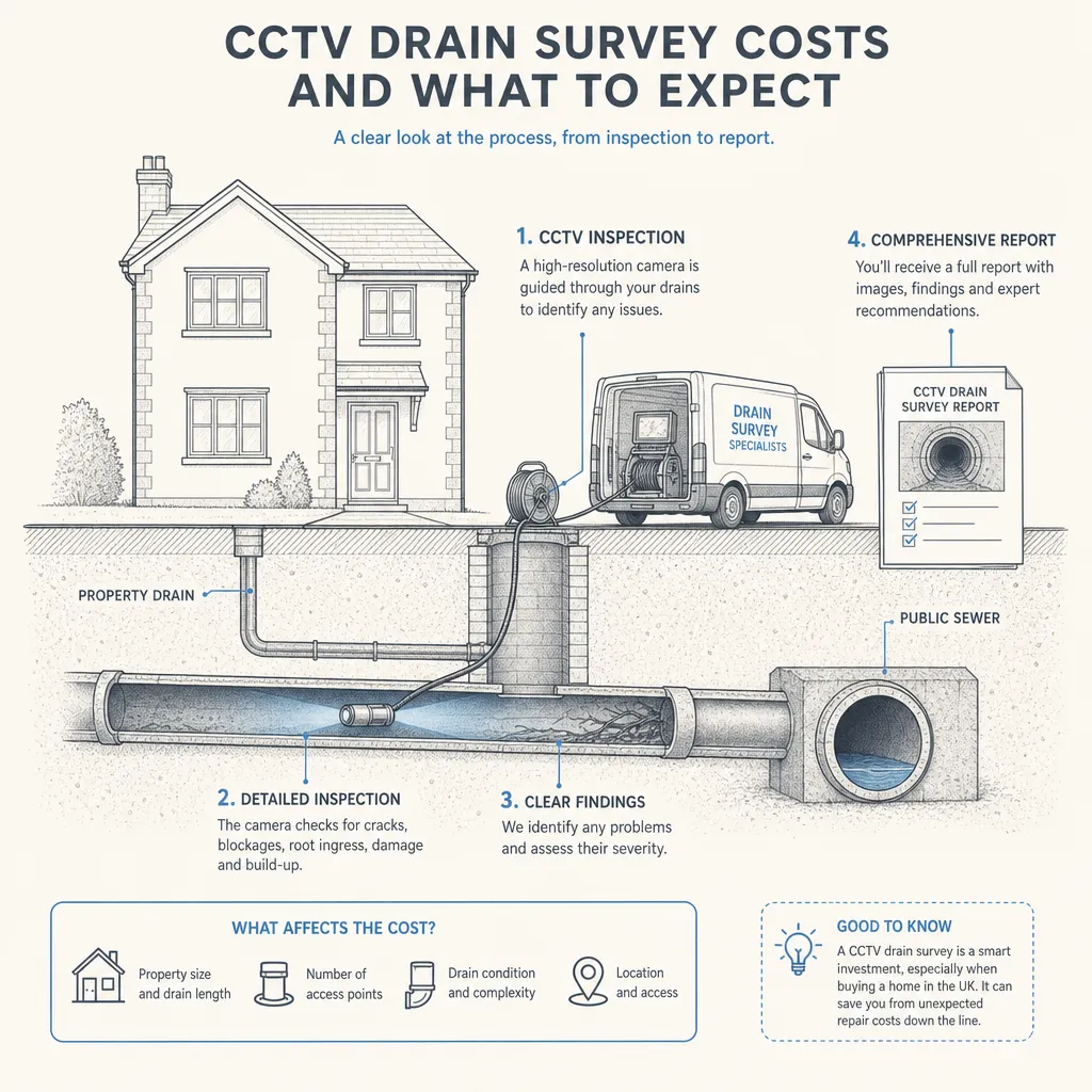
CCTV Drain Survey Costs and What to Expect
A CCTV drain survey in the UK typically costs between £150 and £400 for a standard residential survey covering one or two drainage runs.
 Surveys & Inspections
Structural Building Survey Costs
A RICS Level 3 Building Survey typically costs £500–£1,500 in the UK, depending on property size, age, and location.