Professional Property Boundary Surveying and Land Measurement
By Housey · Last reviewed 1st of June 2026
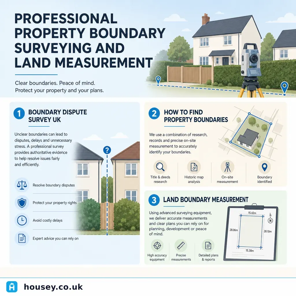
Professional Property Boundary Surveying and Land Measurement
Property boundaries define exactly where your land ends and your neighbour's begins — a question that arises during conveyancing, when planning extensions, after a boundary dispute, or when selling land. In England and Wales, the legal framework around boundaries is more nuanced than most homeowners expect, and the documents that people assume are definitive — title plans from HM Land Registry — are frequently not precise enough to resolve a dispute or support a planning application. UK property titles, especially those originating before compulsory first registration, often rely on historic conveyance plans drawn to inconsistent scales and with imprecise notation.
Key points
- HM Land Registry title plans are drawn to a scale of 1:1,250 (urban) or 1:2,500 (rural) and show general boundaries only — they are not a precise measurement of the legal boundary line.
- A boundary determination report produced by a chartered land surveyor combines title deeds, Ordnance Survey data, conveyance plans, and physical evidence to establish where the legal boundary lies.
Tmarks on conveyance plans indicate which party is responsible for maintaining a boundary feature such as a fence or wall — they do not always indicate ownership of the land itself.- Boundary disputes that cannot be resolved by agreement can be referred to the First-tier Tribunal (Property Chamber) in England, or the Lands Tribunal for Scotland.
- The Party Wall etc. Act 1996 governs work to shared or boundary walls but does not determine land ownership — a separate boundary survey or legal process is needed if ownership is in question.
What does a boundary survey measure?
A professional boundary survey establishes the precise location of the legal boundary between two or more parcels of land. A chartered land surveyor will:
- Review the title register and title plan held at HM Land Registry.
- Examine historical conveyance plans, deeds, and Land Registry documentation to identify the intended boundary.
- Carry out a site survey using GPS or total-station equipment to measure existing physical features (fences, walls, hedges, kerbs).
- Compare physical features against documentary evidence to produce a boundary determination report or boundary agreement plan.
The output is typically a scaled drawing showing the surveyor's opinion of where the boundary lies, supported by written reasoning. In a dispute, this report can be presented to solicitors, mediators, or the First-tier Tribunal.
HM Land Registry title plans: what they show — and don't
The title plan attached to your property's HM Land Registry entry is based on Ordnance Survey mapping. At 1:1,250 scale (the standard for urban areas), a line width of 0.3mm on the plan represents approximately 375mm on the ground — over a foot. HM Land Registry is explicit in Practice Guide 40 that title plans are illustrative only and do not define legal boundaries precisely.
This means:
- You cannot use your title plan to prove that your fence is exactly on the boundary.
- The plan cannot confirm whether a shared wall belongs wholly to you, wholly to your neighbour, or is jointly owned.
- Plans are updated infrequently and may not reflect alterations made after the land was first registered.
For most day-to-day ownership questions this is not a problem. It only matters when you need precision — during a dispute, when developing land close to a boundary, or when preparing an accurate plan for a planning application.
When do you need a boundary survey?
Decision tree: which service do you need?
- Choose a boundary determination survey if you are in a dispute with a neighbour about where the boundary lies, if you are buying or selling land adjacent to an unclear boundary, or if you need a precise plan for planning permission or a building contract.
- Choose topographical surveys if you need accurate measurements of your whole site — levels, features, drainage, and structures — for a design or planning application, but boundary ownership is not in dispute.
- Choose measured building surveys if you need precise internal and external dimensions of a building rather than the land boundary itself.
- Consult party wall surveyors if you intend to carry out work to a shared or boundary wall under the Party Wall etc. Act 1996 — this is a separate process from establishing ownership.
- Seek legal advice if a boundary dispute has escalated and you need to understand your options under the Land Registration Act 2002 or consider a First-tier Tribunal application.
Boundary survey vs topographical survey vs measured building survey
Survey type | What it establishes | Typical use case | Typical professional |
|---|---|---|---|
Boundary determination survey | The legal line between two land parcels | Dispute resolution, land sale, development near a boundary | Chartered land surveyor (RICS) |
Topographical survey | Levels, features, and physical layout of a site | Design, planning applications, drainage studies | Land surveyor or engineering surveyor |
Measured building survey | Internal and external dimensions of a building | Renovation, listed building works, space planning | Architectural or building surveyor |
Party wall survey | Rights and obligations for works to a shared wall | Extensions, loft conversions, basement works | Party wall surveyor |
Worked UK property scenario
Situation: A homeowner in a 1930s semi-detached property in the East Midlands plans to build a single-storey rear extension to within 50mm of the side boundary. The neighbour disputes where the boundary lies — the existing close-board fence was erected in 2003 and may not be in its original position.
What happened:
- The solicitor retrieved the title register and title plan from HM Land Registry — the plan is at 1:1,250 scale and shows only a general boundary.
- A chartered land surveyor was instructed to carry out a boundary determination survey, examining the 1934 conveyance plan, neighbouring title deeds, and OS mapping from multiple periods.
- The surveyor conducted a GPS site survey and measured the physical position of the fence, party wall, and original house corners.
- The surveyor's report concluded the legal boundary was approximately 200mm to the east of the current fence line, with written reasoning citing the 1934 conveyance.
- Both parties' solicitors reviewed the report; the boundary was agreed by deed — a formal boundary agreement registered at HM Land Registry.
This process avoided a First-tier Tribunal application, which can cost several thousand pounds per party.
What to ask a boundary surveyor before instructing
Before accepting a quote, ask:
- What qualifications and professional body membership do you hold? (RICS or ICES membership is the relevant benchmark.)
- What documents will you review as part of the survey?
- Will your report state your opinion of the boundary location and the reasoning behind it?
- Can your report be used as expert evidence if the matter goes to the First-tier Tribunal?
- What assumptions is your determination based on, and what could affect your conclusion?
- Will the boundary determination need to be registered at HM Land Registry, and is that included in your fee?
- Is VAT included?
Important limitations
This article provides general information only. Boundary law in England and Wales — and Scotland under separate legislation — is complex. The interpretation of title deeds, conveyance plans, and physical evidence requires professional expertise, and outcomes vary significantly depending on the age of the title, the quality of historic documentation, and the nature of any dispute. This guide does not constitute legal or surveying advice. Always instruct a qualified professional before taking action on a boundary matter.
What to ask a qualified professional
- What is your professional body membership (RICS, ICES) and do you carry professional indemnity insurance?
- Have you handled disputes involving properties of a similar age and type to mine?
- If we cannot agree a boundary with the neighbour, what would you recommend as the next step?
- Can you advise on registering a boundary agreement or determined boundary at HM Land Registry?
- Are there any physical features on site — for example, a hedge that predates the title — that could affect your determination?
When to get professional help
Instruct a chartered land surveyor or a solicitor with property law experience before taking further action if:
- You or your neighbour have moved, altered, or disputed the position of a fence, wall, or hedge.
- You are planning to build within 500mm of what you believe to be the boundary line.
- A solicitor has flagged a boundary discrepancy during conveyancing.
- You have received a letter before action or a notice of application to the First-tier Tribunal.
- The boundary involves a watercourse, access strip, or ransom strip.
How Housey can help
Housey connects you with qualified boundary surveyors who can carry out determinations, produce boundary agreement plans, and provide expert reports for dispute resolution or development. If your project also involves shared walls or planned works close to a boundary, our party wall surveyors can advise on your obligations under the Party Wall etc. Act 1996. For site-wide measurement supporting a planning application or design brief, topographical surveys provide the precision a design team requires.
Frequently asked questions
Does HM Land Registry record the exact boundary of my property?
No. HM Land Registry title plans are based on Ordnance Survey mapping at 1:1,250 scale (urban) and show general boundaries only. A line at this scale has a ground uncertainty of roughly 375mm. For precise measurement you need a boundary determination survey carried out by a chartered land surveyor.
Who owns the fence between my property and my neighbour's?
Ownership of a boundary feature such as a fence, wall, or hedge depends on the title deeds and any conveyance plans attached to them — not on which side the posts are on. T marks on conveyance plans indicate who is responsible for maintaining a feature, but are not always conclusive about ownership. A boundary surveyor can review the documentation and advise.
Can I move a fence without a boundary survey?
Moving a fence is not automatically unlawful, but if there is any uncertainty about the boundary — or if your neighbour disputes the position — you risk escalating a disagreement into a formal dispute. If in doubt, have the boundary assessed by a chartered surveyor before moving or replacing any boundary feature.
How long does a boundary survey take?
A straightforward boundary determination typically takes two to six weeks from instruction to report, depending on title complexity, the availability of historic documents, and the site investigation required. Disputed boundaries involving multiple properties and historic deeds can take longer.
Can a boundary dispute affect my property sale?
Yes. A known or suspected boundary dispute is a material fact that sellers in England and Wales must disclose on the TA6 property information form. Buyers' solicitors will investigate, and a dispute unresolved at exchange can delay or prevent completion.
Sources and further reading
- HM Land Registry Practice Guide 40: Land Registry Plans — HM Land Registry
- HM Land Registry Practice Guide 76: Adverse Possession — HM Land Registry
- Party Wall etc. Act 1996 — legislation.gov.uk
- Land Registration Act 2002 — legislation.gov.uk
- First-tier Tribunal (Property Chamber) — GOV.UK
- RICS guidance on boundary disputes — RICS
Useful next reads
 Surveys & Inspections
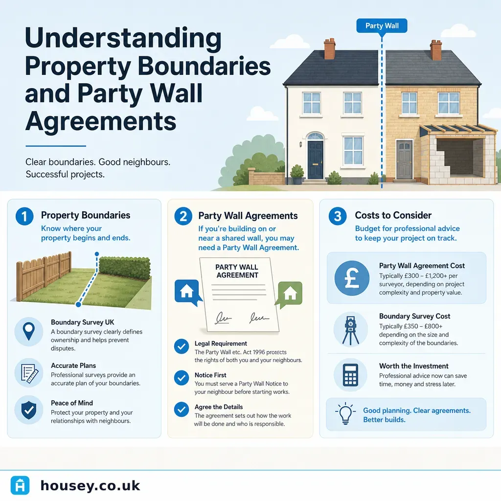
Understanding Property Boundaries and Party Wall Agreements
Property boundaries define the legal extent of your land; the Party Wall etc.
 Surveys & Inspections
Engaging a Land Surveyor: Questions to Clarify Scope and Deliverables
When engaging a land surveyor, clarify exactly which type of survey you need — topographical, boundary, or measured building — before agreeing a fee.
 Surveys & Inspections
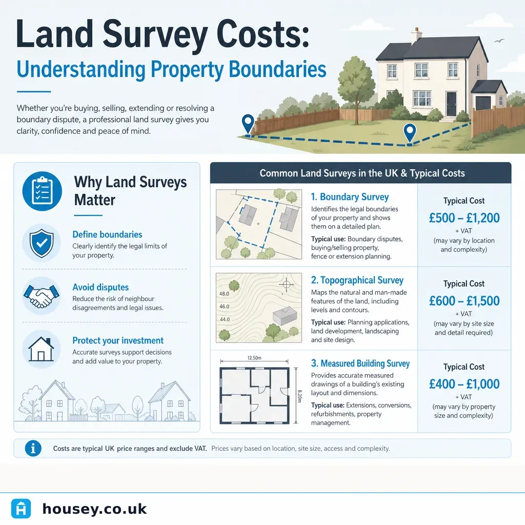
Land Survey Costs: Understanding Property Boundaries
Land survey costs in the UK depend on the type of survey needed: boundary surveys typically cost £500–£2,000, topographical surveys £600–£2,500, and measured building surveys £800–£3,000 for a standard house.
 Surveys & Inspections
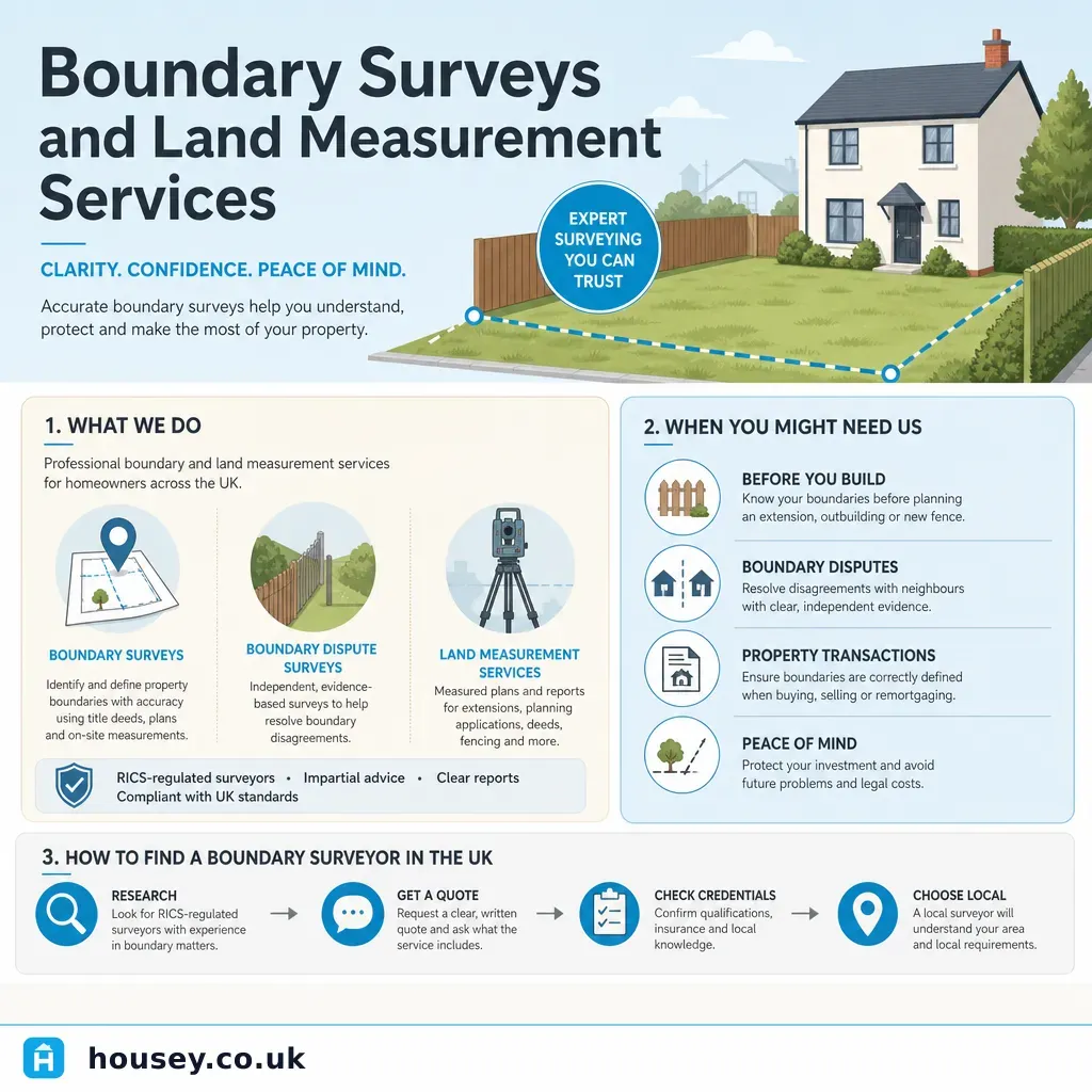
Boundary Surveys and Land Measurement Services
A boundary survey establishes where the legal boundary of a property sits, using title deeds, historic maps, and on-site measurement.
 Surveys & Inspections
Land and Property Surveying Costs
Land survey costs in the UK typically range from around £400 for a simple boundary check to £3,000 or more for a detailed topographical or measured building survey of a large site.