Types of Land Surveys: Choosing the Right Survey for Your Needs
By Housey · Last reviewed 26th of May 2026
Types of Land Surveys: Choosing the Right Survey for Your Needs
Land and property surveys serve very different purposes, and selecting the wrong type can waste time and money — or leave critical questions unanswered before construction begins or a legal dispute escalates. Whether you're applying for planning permission on a Victorian terrace, resolving a boundary disagreement with a neighbour, or preparing for a basement excavation on a 1930s semi, there is a specific survey type designed for the task.
Key points
- Topographical surveys produce a georeferenced plan of ground levels, features, and physical structures — typically at 1:200 or 1:500 scale — and are usually required as a base drawing before any significant planning application or design work.
- HM Land Registry title plans are drawn at 1:1250 (urban) or 1:2500 (rural) scale, which is not precise enough to determine a legal boundary position; a specialist boundary surveyor is needed for disputes.
- Measured building surveys record the geometry of existing structures to floor plan, section, and elevation drawings, typically to ±10 mm accuracy, and form the base drawings for extension and conversion design.
- The Party Wall etc. Act 1996 requires written notice to neighbours before certain works, including excavations within 3–6 metres of an adjoining structure or structural works to a shared party wall.
- Ground investigation surveys assess soil bearing capacity and contamination risk; building control will usually require this data before approving foundations for new builds or significant extensions.
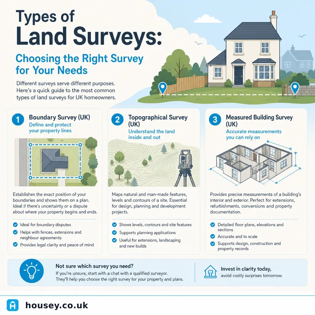
The main types of land survey explained
Topographical survey
A topographical (or topo) survey captures the physical landscape: ground levels, contours, trees, drainage features, boundary indicators, buildings, and services. It is delivered as a georeferenced CAD or PDF drawing, typically at 1:200 or 1:500 scale. Architects, engineers, and planning consultants use topographical surveys as the base drawing for all design work.
When you need one: before planning an extension, self-build, new vehicular access, drainage scheme, or any project where accurate ground levels are needed.
Typical accuracy: ±10–50 mm depending on specification and terrain.
Measured building survey
A measured building survey records the geometry of an existing structure — floor plans, elevations, sections, and roof plans. The output is a set of precise CAD drawings used for refurbishment design, extension planning, or heritage documentation. Some measured surveys use 3D laser scanning (LiDAR) for complex or large structures.
When you need one: designing an extension or conversion where original drawings no longer exist, applying for listed building consent, or producing as-built drawings for a completed project.
Typical accuracy: ±5–10 mm for standard surveys; sub-millimetre for laser-scan work.
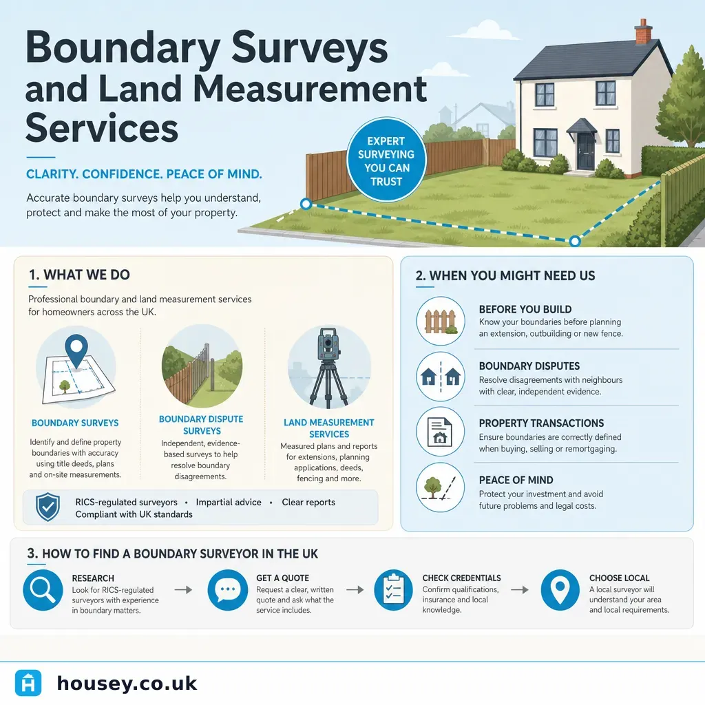
Boundary survey
A boundary survey investigates the legal position of a boundary between two or more land parcels. It draws on title deeds, Land Registry records, historic Ordnance Survey mapping, and physical evidence on site. The surveyor produces a report and, where appropriate, a measured plan showing their professional opinion of the boundary position.
When you need one: a dispute with a neighbour, a discrepancy between the title plan and the physical boundary, purchasing land with unclear limits, or before erecting a wall or fence close to a shared boundary.
Important: a boundary surveyor's report is a professional expert opinion, not a legally binding determination. If a dispute continues, a boundary agreement, deed of rectification, or court proceedings may follow.
Ground investigation survey
A ground investigation assesses the bearing capacity, contamination history, and stability of the ground beneath a site. Methods include trial pits, boreholes, and laboratory soil analysis. Building control officers and structural engineers require ground investigation data for new foundations on any but the most straightforward sites.
When you need one: new build, basement construction, significant extension, or any site with a history of industrial use, landfill, or known ground instability.
Party wall survey
Under the Party Wall etc. Act 1996, certain works require written notice to neighbours — including excavations within 3–6 metres of an adjoining structure, works to a party wall, and new structures on the boundary. If a dispute arises — or as a precaution — a party wall surveyor prepares a Party Wall Award setting out how works will proceed, together with a schedule of condition documenting the neighbour's structure before work begins.
When you need one: loft conversions, basement excavations, underpinning, or structural alterations within the scope of the 1996 Act.
Which survey do I need?
- Choose a topographical survey if you are planning an extension, new build, or development and need accurate ground levels and site features as a base for design.
- Choose a measured building survey if you are redesigning an existing building and need accurate floor plans, sections, or elevations where original drawings do not exist.
- Choose a boundary survey if you have a dispute with a neighbour about where the legal boundary sits, or if your title plan and the physical boundary do not match.
- Choose a ground investigation if you are designing new foundations, working on a site with suspected contamination, or building on land with a known geological risk.
- Ask a party wall surveyor if your project involves excavation within 3–6 metres of a neighbour's structure, works to a shared wall, or a new structure on the boundary line.
- Check with your local planning authority if you are unsure what surveys your planning application requires — requirements vary by application type and local authority.
Comparison: land survey types at a glance
Survey type | Primary output | Typical use | Who carries it out | Regulated body |
|---|---|---|---|---|
Topographical | Georeferenced CAD plan | Design, planning applications | Geomatics or land surveyor | RICS, CICES |
Measured building | CAD plans, elevations, sections | Extension design, listed building consent | RICS surveyor or CAD technician | RICS |
Boundary | Expert report and measured plan | Disputes, conveyancing, boundary agreements | RICS-accredited boundary surveyor | RICS |
Ground investigation | Borehole logs, soil analysis | Foundations, contaminated sites | Geotechnical engineer | ICE, Ground Forum |
Party wall | Schedule of condition, Party Wall Award | Works under Party Wall etc. Act 1996 | Party wall surveyor | RICS, Faculty of Party Wall Surveyors |
CCTV drainage | Video footage, condition report | Drainage defects, pre-purchase checks | Drainage specialist | WRc |
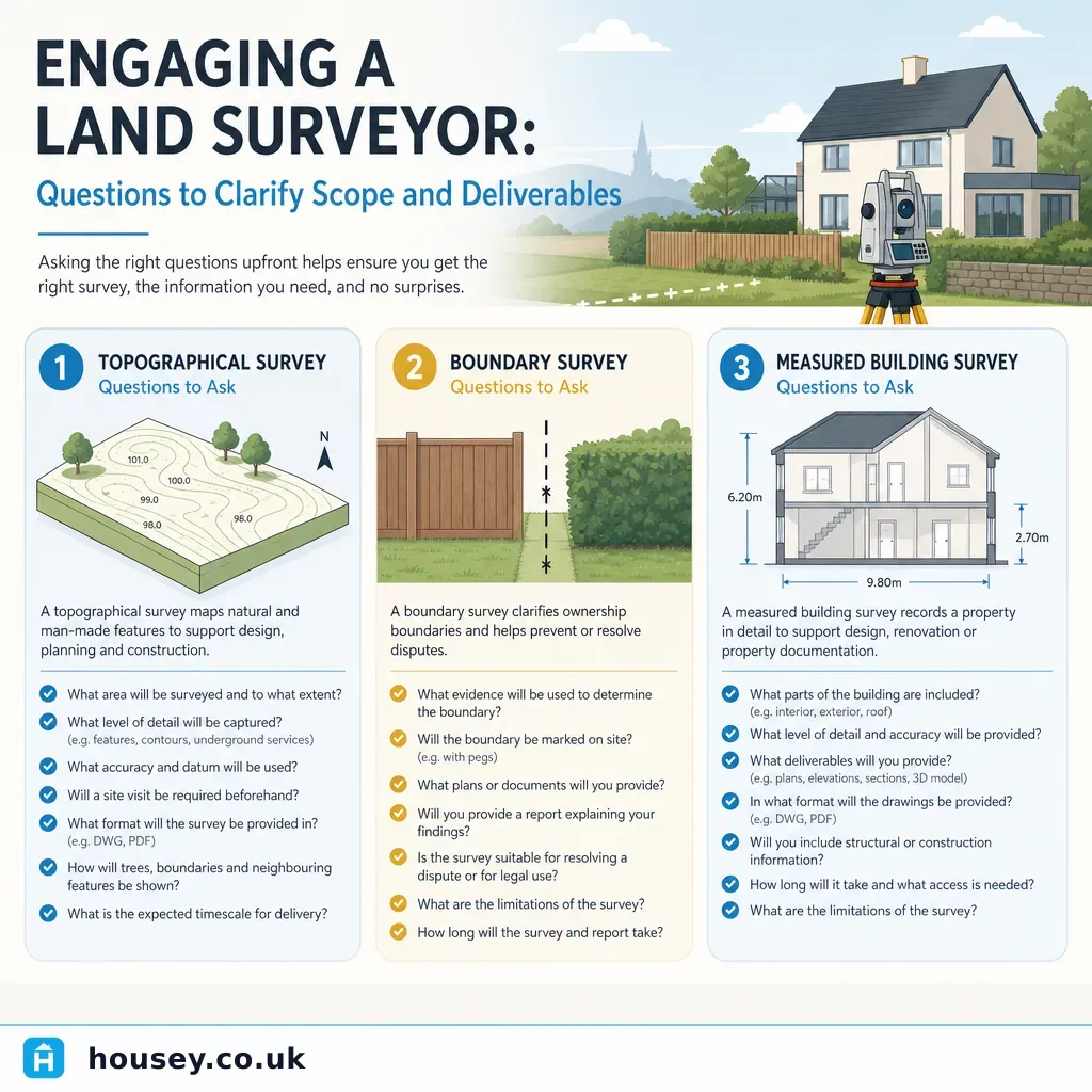
What to ask a surveyor before instructing
- What is your professional accreditation — RICS, CICES, or Faculty of Party Wall Surveyors?
- What format will the survey be delivered in (CAD, PDF, GIS), and at what scale?
- Will the survey tie into Ordnance Survey National Grid coordinates?
- What accuracy standard is the survey specified to, and how will it be verified on site?
- What is included in the fee, and what could lead to additional costs (access restrictions, dense vegetation, utility locating)?
- Will you attend site personally, or will a technician carry out the fieldwork?
- What is the expected turnaround from site visit to delivery of final drawings?
When to get professional help
Land and boundary surveys involve technical disciplines where errors carry legal and financial consequences. Always instruct a qualified and accredited surveyor:
- Do not rely solely on HM Land Registry title plans to resolve a boundary dispute — the scale is not sufficient for legal boundary determination.
- Do not commission a topographical survey without agreeing the specification (scale, accuracy, features, coordinate system) in writing before fieldwork begins.
- If you are applying for planning permission, consult your architect or planning consultant on the survey specification they need before instructing a surveyor.
How Housey can help
Housey connects homeowners and developers with qualified surveyors across the UK. Whether you need a topographical survey for a planning application, a measured building survey for extension design, specialist boundary surveyors for a neighbour dispute, or party wall surveyors ahead of notifiable works, submit a brief and receive quotes from vetted local professionals.
Frequently asked questions
What is the difference between a boundary survey and a topographical survey?
A boundary survey investigates and provides a professional opinion on the legal position of a land boundary, using title deeds, Land Registry data, and physical evidence on site. A topographical survey records physical features and ground levels for design and planning purposes. The two serve entirely different purposes — one resolves or documents legal limits; the other provides a base drawing for a design team.
Do I need a land survey before applying for planning permission?
Most planning applications beyond a simple householder application require a topographical survey as a base drawing for the design. Your architect or planning consultant will advise on the specification required. For simple householder applications, an accurately scaled block plan may be sufficient — check with your local planning authority for the requirements of your specific application.
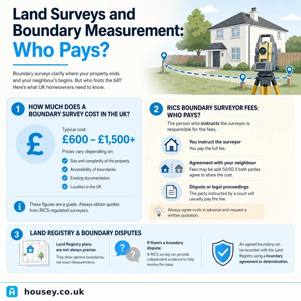
How much does a topographical survey cost in the UK?
Indicative UK costs, last reviewed 2026-05-26. Residential topographical surveys typically range from £500–£1,500 for a standard plot, depending on site size, complexity, vegetation density, and access. Larger or more complex sites cost more. Always request an itemised quote specifying accuracy, scale, deliverable format, and features to be captured. Fees vary significantly by region and surveying firm.
Sources and further reading
- HM Land Registry: understanding the title plan — HM Land Registry
- Party Wall etc. Act 1996 — legislation.gov.uk
- RICS standards and guidance: boundaries — Royal Institution of Chartered Surveyors
- Ordnance Survey: guide to OS map scales — Ordnance Survey
Useful next reads
 Surveys & Inspections
Boundary Surveys and Land Measurement Services
A boundary survey establishes where the legal boundary of a property sits, using title deeds, historic maps, and on-site measurement.
 Surveys & Inspections
Engaging a Land Surveyor: Questions to Clarify Scope and Deliverables
When engaging a land surveyor, clarify exactly which type of survey you need — topographical, boundary, or measured building — before agreeing a fee.
 Surveys & Inspections
Choosing Your Own RICS Surveyor: Independence From Estate Agents
You have every right to choose your own RICS surveyor independently of your estate agent's recommendation.
 Surveys & Inspections
Land Surveys and Boundary Measurement: Who Pays
There is no statutory rule in England and Wales that determines who pays for a boundary or land survey.
 Surveys & Inspections
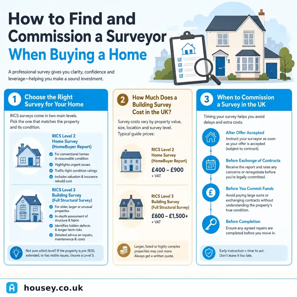
How to Find and Commission a Surveyor When Buying a Home
To commission a surveyor when buying a home, use the RICS Find a Surveyor tool to identify a regulated professional, choose between a RICS Level 2 Home Survey or Level 3 Building Survey based on the property's age and condition, and book as soon as your offer is accepted.