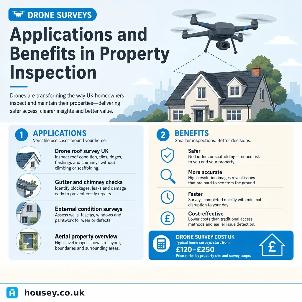
Drone Surveys: Applications and Benefits in Property Inspection
By Housey · Last reviewed 12th of May 2026
Drone Surveys: Applications and Benefits in Property Inspection
Drone technology has become a practical option for UK property inspections over the past decade, offering access to parts of a building that were once expensive or dangerous to reach without scaffolding or cherry-picker hire. Whether you are buying an older home with an inaccessible roof, managing a large commercial building, or assessing chimney stack damage after a storm, understanding what drone surveys can and cannot do helps you decide when they add genuine value — and when a traditional hands-on inspection remains essential.
Key points
- Commercial drone operators in the UK must hold a Flyer ID and Operator ID issued by the Civil Aviation Authority (CAA) and carry public liability insurance as required under the Air Navigation Order.
- Drone surveys are most commonly used for roof inspections, chimney stacks, guttering, large commercial buildings, and heritage or listed properties where scaffolding access is restricted or impractical.
- Thermal imaging drones detect heat loss, moisture ingress, and insulation defects invisible to standard cameras — accuracy is greatest when there is a temperature differential of at least 10°C between inside and outside.
- A drone survey does not replace a RICS Home Survey: it is a complementary inspection tool, not a structural assessment, and RICS surveyors will note it accordingly.
- Flight restrictions apply near airports, helipads, and in certain congested built-up areas; a reputable operator confirms airspace clearance using the CAA drone safety map before every flight.
What drone surveys are used for in UK property
Drone surveys provide aerial photography and video of building fabric that is difficult or costly to access by other means. In residential property, the most common applications are:
- Roof inspections: assessing tile or slate condition, ridge pointing, lead flashings, flat roof membranes, and moss or lichen growth.
- Chimney and stack assessment: checking mortar joints, pot condition, and flaunching from above — areas where inspection from ground level is often insufficient.
- Guttering and fascias: identifying blockages, sagging runs, or failing joints.
- Large or complex buildings: commercial properties, barn conversions, or multi-unit developments where foot access to every roof plane is impractical.
- Heritage and listed buildings: inspections where physical access would risk damage to historic fabric.
- Post-storm assessment: rapid inspection after wind or hail damage to identify urgent repairs before instructing roofers.
Drones are less useful for interior inspections, underground drainage, structural assessment, or areas concealed behind cladding — these require different survey methods.
Drone surveys versus traditional inspection methods
Understanding where drone surveys outperform conventional access methods — and where they fall short — helps you choose the right approach for your property.
Inspection method | Best for | Not ideal for | Typical cost indicator | Main limitation |
|---|---|---|---|---|
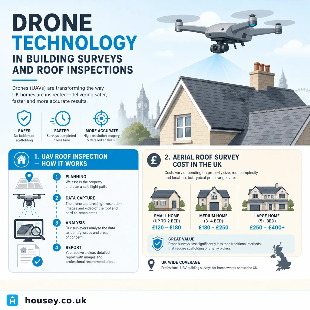
Drone survey (visual) | Roofs, chimneys, gutters, large buildings, post-storm checks | Structural assessment, interior, concealed defects | £150–£400 depending on building size* | No physical testing; cannot detect sub-surface moisture or soft areas |
Drone with thermal camera | Heat loss surveys, moisture detection, flat roof leaks | Precise measurement, structural diagnosis | £300–£700* | Accuracy depends on temperature differential; best in cooler weather |
Traditional ladder or scaffold | Detailed hands-on inspection, material sampling | Height risk, cost on tall buildings, disruption | Scaffold: £500–£2,000+* | Time-consuming and expensive for multi-storey properties |
RICS Level 2 or Level 3 survey | Full property condition assessment, legal protection | High-level roof detail where access is impossible | Varies by property size and surveyor | May note "unable to inspect" for inaccessible roof elements |
Cherry picker or MEWP | Close-up hands-on access at height | Traffic management, road space, cost | £300–£800 per day hire* | Requires sufficient space and sometimes a traffic management plan |
*Indicative UK costs, last reviewed 2026-05-12. Quotes vary by location, building size, and operator. Always request itemised written quotes.
CAA regulations and operator requirements
The Civil Aviation Authority (CAA) regulates all drone activity in the UK under the Air Navigation Order and the retained UK drone regulation framework. Key requirements for commercial operators include:
- Operator ID: any organisation or individual using a drone commercially must register as an operator with the CAA.
- Flyer ID: the person piloting the drone must hold a valid CAA Flyer ID, obtained by completing an online theory test.
- GVC (General VLOS Certificate): required for many commercial operations; operators flying drones above 250g in open or specific categories must meet additional competency requirements.
- Insurance: the Air Navigation Order requires third-party liability insurance for commercial drone operations. Most reputable operators carry at least £1 million public liability cover; many carry £5 million or more.
- Airspace restrictions: drones must not fly within restricted zones near airports or helipads, or over congested areas, without specific authorisation. Operators should check NATS Drone Assist or the CAA drone safety map before every flight.
Always ask to see a copy of the operator's CAA Operator ID, Flyer ID or GVC certificate, and current insurance certificate before instructing any drone survey.
Thermal imaging drone surveys
A thermal imaging drone carries an infrared camera that detects temperature differences in building fabric. In property inspection, this is used to identify:
- Insulation defects: cold spots in walls, ceilings, or roofs indicating missing or damaged insulation.
- Moisture ingress: wet building materials retain heat differently from dry ones, making active leaks visible under the right conditions.
- Flat roof leaks: saturated insulation beneath a membrane often shows clearly in thermal images.
- Air leakage: gaps around windows, doors, or service penetrations where warm air escapes.
Thermal surveys are most accurate in cooler UK conditions — autumn and winter mornings typically provide the best temperature differential. Results should be interpreted by someone with recognised thermography training; the images alone are not diagnostic without professional expertise.
What to ask before instructing a drone survey operator
Use this checklist before accepting any quote:
- What CAA credentials do you hold, and can I see your Operator ID, Flyer ID or GVC certificate, and insurance documentation?
- What is your public liability cover level?
- Will you check airspace restrictions before the survey date, and what happens if the flight cannot proceed?
- What resolution and format will imagery be delivered in — annotated stills, raw photos, or edited video?
- Does the quote include a written report with annotated findings, or raw footage only?
- If thermal imaging is included, what qualifications does the report interpreter hold?
- What is explicitly excluded from the survey scope?
- What assumptions does the quote rest on — clear weather, suitable take-off location, unobstructed line of sight?
- Is VAT included in the quoted price?
Red flags when assessing drone survey operators
- No CAA Operator ID, Flyer ID, or GVC — or unwillingness to provide documentation on request.
- No public liability insurance certificate available.
- Proposal to fly near an airport or helipad without prior airspace authorisation.
- Quote delivers raw video files only with no annotation, written report, or professional commentary.
- Pressure to proceed without confirming weather conditions or airspace clearance.
- Price significantly below market rate with vague scope — often indicates a superficial overflight with no actionable output.
When to get professional help
A drone survey is a useful inspection tool but it does not replace specialist professional assessment in every situation.
- If the drone survey identifies roof defects, cracked flashings, or signs of structural movement, instruct a chartered building surveyor or structural engineer for a hands-on assessment before instructing any repair work.
- If you are buying a property and the RICS survey notes "unable to inspect roof" due to access, a drone survey can provide additional intelligence — but share findings with your surveyor rather than acting on imagery alone.
- If thermal imaging suggests moisture ingress, a specialist damp and timber survey is usually needed to diagnose the source, extent, and appropriate remedy.
- For heritage or listed buildings, consult a building conservation specialist alongside any visual drone inspection.
How Housey can help
If you need a detailed assessment of a roof or other hard-to-reach building element, Housey connects you with qualified professionals offering roof surveys across the UK. Compare quotes and credentials from vetted inspection providers to find the right approach for your property.
Frequently asked questions
Do I need planning permission for a drone survey on my property?
Planning permission is not typically required for a drone survey of a residential property in England, but the operator must still comply with CAA regulations covering airspace restrictions, Operator ID, and Flyer ID. Always confirm that location-specific restrictions — including proximity to airports or helipads — have been checked before any flight.
Can a drone survey replace a RICS Home Survey?
No. A drone survey provides visual aerial imagery of the building exterior but cannot carry out structural assessment, condition ratings, or provide the legal protection of a RICS Home Survey. It works best as a complementary tool when roof or high-level access would otherwise be restricted or unavailable to the surveyor.
How long does a residential drone survey take?
A typical residential drone survey takes 30 minutes to 2 hours on site depending on building size and weather. Report preparation and image annotation may add one or more working days. Confirm turnaround times and the format of deliverables with your operator before booking.
Is a thermal imaging drone survey useful for detecting damp?
Thermal imaging drones can identify heat and moisture anomalies in building fabric — particularly in flat roofs, external walls, and insulation layers. Results require expert interpretation, and a specialist damp and timber survey is usually needed to confirm the source, extent, and appropriate remedy of any moisture ingress identified.
Sources and further reading
- CAA drone registration and rules — Civil Aviation Authority
- UK Drone Code — Civil Aviation Authority
- RICS Home Survey Standard — RICS
- Energy Saving Trust — home insulation — Energy Saving Trust
- NATS Drone Assist — NATS / Drone Safe UK
Useful next reads
 Surveys & Inspections
Drone Technology in Building Surveys and Roof Inspections
Drone surveys use unmanned aerial vehicles (UAVs) to capture high-resolution images of roofs, chimneys, gutters, and other inaccessible areas without scaffolding.
 Surveys & Inspections
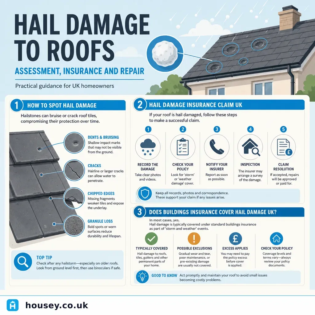
Hail Damage to Roofs: Assessment, Insurance and Repair
Hail damage to a roof commonly shows as cracked or chipped tiles, granule loss on flat roofs, dented flashings, and water ingress.
 Surveys & Inspections
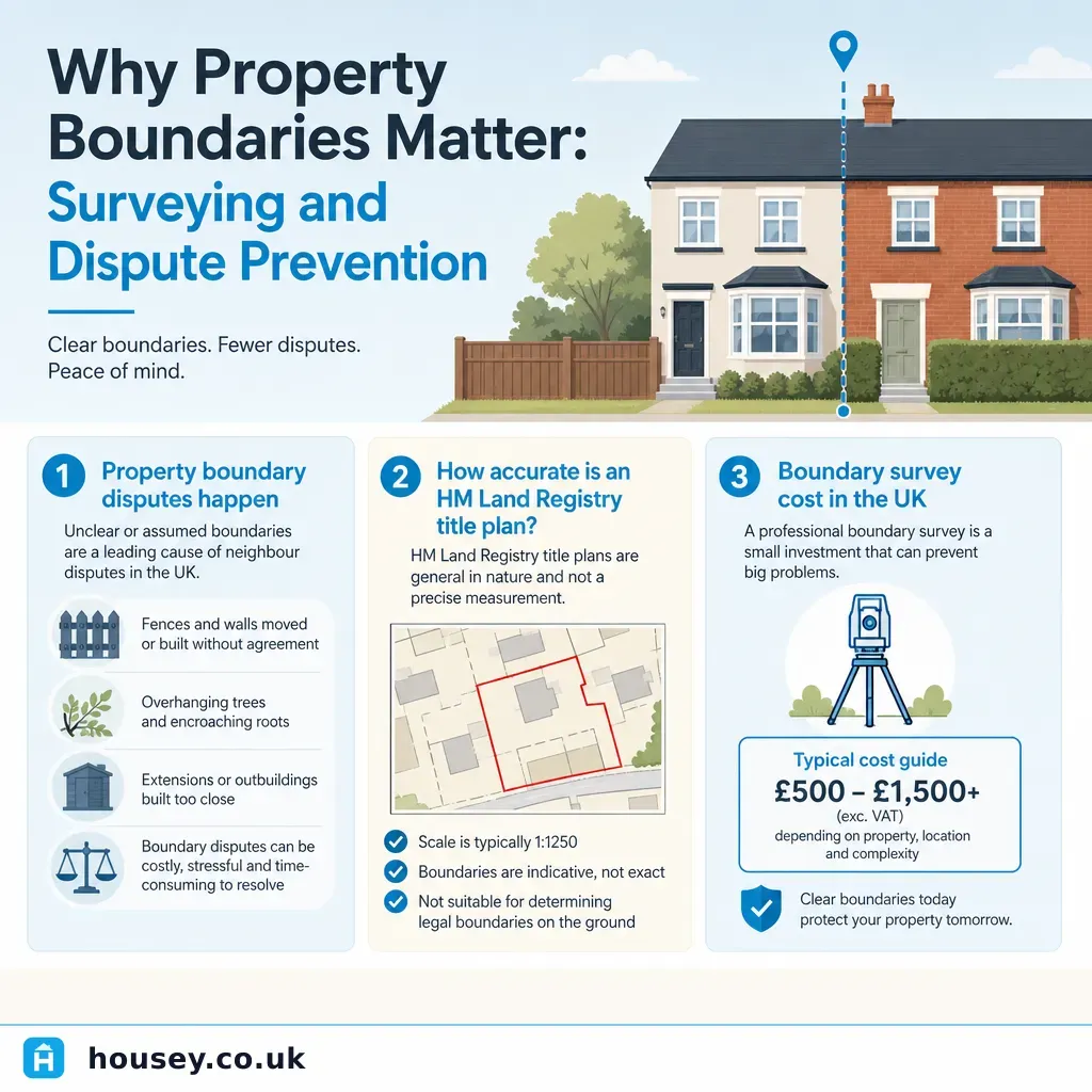
Why Property Boundaries Matter: Surveying and Dispute Prevention
Property boundaries in England and Wales are recorded as general boundaries by HM Land Registry — not precise measurements.
 Surveys & Inspections
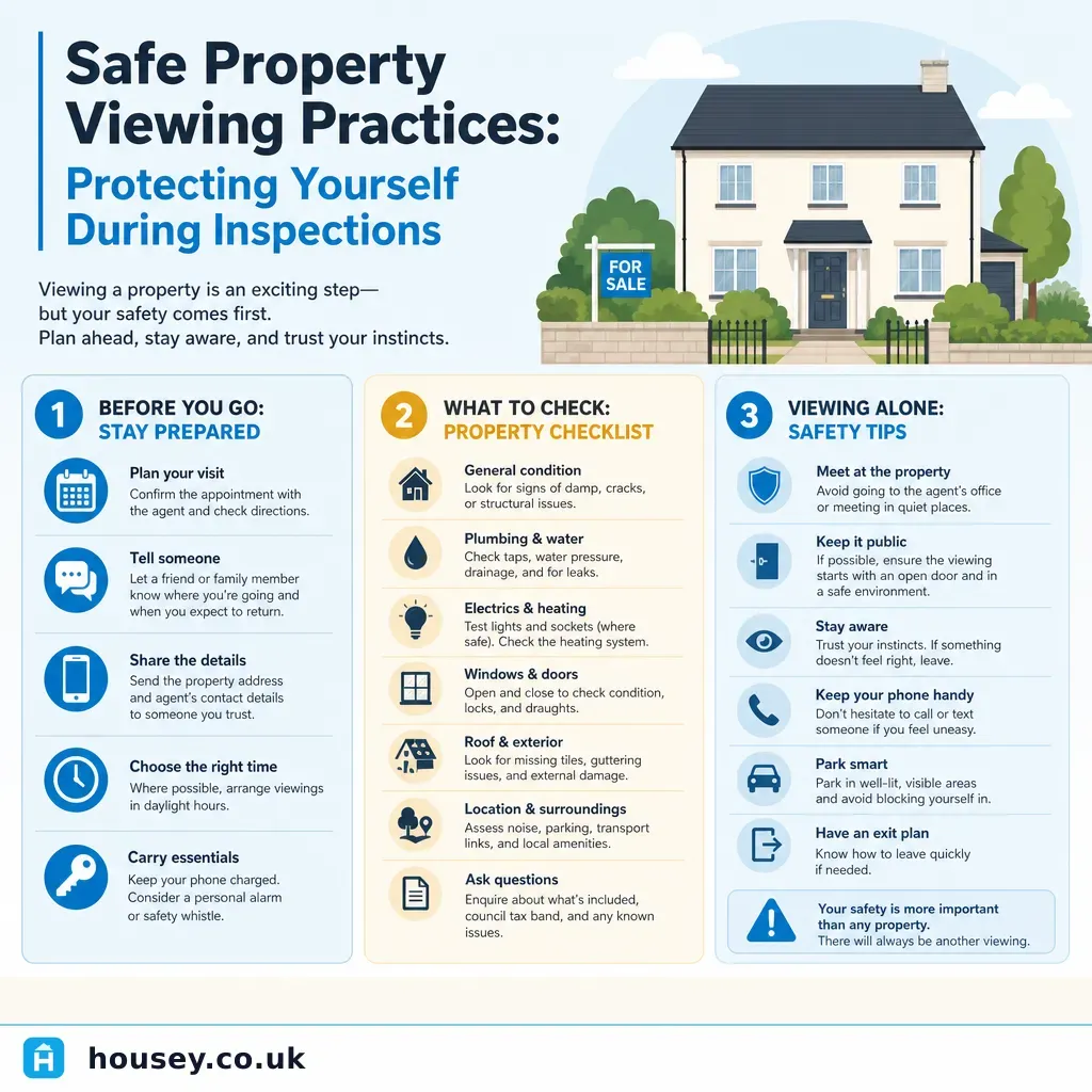
Safe Property Viewing Practices: Protecting Yourself During Inspections
When viewing a property in the UK, always tell someone where you are going and share the full address before you leave.
 Surveys & Inspections
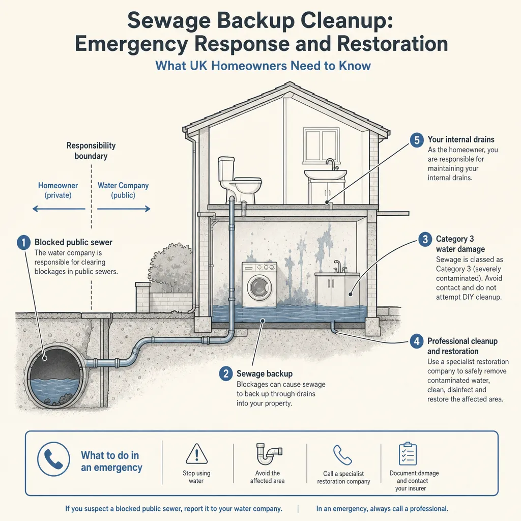
Sewage Backup Cleanup: Emergency Response and Restoration
A sewage backup should be treated as a Category 3 contamination event.