Protecting Your Property from Ground Liquefaction Damage: Geological Assessment
By Housey · Last reviewed 1st of June 2026
Protecting Your Property from Ground Liquefaction Damage: Geological Assessment
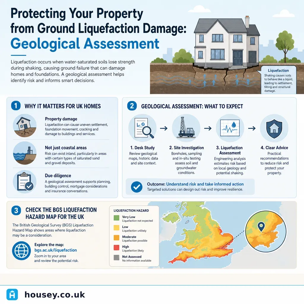
Ground liquefaction is a soil behaviour that receives little attention in routine property decisions, yet it poses a genuine structural risk for homes built on certain types of made ground, alluvial deposits, and reclaimed land — conditions found across a wider range of UK locations than many homeowners expect. The question of liquefaction risk typically comes to the fore when buying property on unfamiliar ground, commissioning pre-build site investigations, or reviewing a geo-environmental search result that has flagged susceptible superficial deposits.
Key points
- Soil liquefaction occurs when saturated, loosely packed granular soils temporarily lose load-bearing capacity under vibration or shaking, allowing structures above to sink, tilt, or experience differential settlement.
- In the UK, susceptibility is most associated with Holocene alluvial deposits, estuarine silts, tidal flat sediments, reclaimed dockland land, and post-industrial made ground — concentrated around major river estuaries, low-lying coastal areas, and former industrial waterfront sites.
- The British Geological Survey (BGS) publishes a free GeoIndex and Hazard Map at bgs.ac.uk/geoindex that provides a national-scale indication of superficial deposits associated with liquefaction susceptibility.
- A geotechnical ground investigation — typically involving boreholes, Standard Penetration Tests (SPT), and laboratory testing — is the only reliable method to assess site-specific liquefaction potential.
- In the UK, liquefaction risk is not exclusively seismic: vibration from nearby pile-driving, dewatering operations, and heavy construction activity can trigger similar soil behaviour in susceptible ground conditions.
What is ground liquefaction and when does it matter in UK property
Liquefaction is a ground condition rather than a structural defect in the building itself. When loosely packed, water-saturated sand or silt is subject to sudden stress — typically earthquake shaking, but also pile-driving, vibration from adjacent construction, or rapid drawdown of groundwater — the soil particles temporarily lose frictional contact with one another. Load-bearing capacity falls sharply, allowing structures above to sink, tilt, or experience differential settlement.
In the UK context, large-scale seismic liquefaction events of the kind witnessed in Christchurch, New Zealand (2010–2011) are not anticipated given the UK's comparatively low seismicity. However, the British Geological Survey notes that certain superficial geological deposits in England, Wales, and Scotland — particularly Holocene alluvium, estuarine silts, and some post-industrial made ground — are considered potentially susceptible. This matters most in three situations:
- Pre-purchase or pre-build investigation — where a site falls within a zone indicated by BGS data as having susceptible deposits.
- Proposed construction on brownfield or reclaimed land — where fill materials and historical ground conditions may not meet modern foundation design standards.
- Unexplained differential settlement in existing buildings — particularly in older properties on riverside or coastal sites, where liquefaction-influenced movement may have contributed to historical cracking or tilting.
How UK liquefaction risk is assessed
Desk study
A preliminary geotechnical desk study reviews BGS geological maps, borehole records from the BGS National Geoscience Data Centre, historical Ordnance Survey maps, aerial photographs, and available environmental search data. This stage identifies the likelihood of susceptible deposits being present and informs whether intrusive investigation is warranted.
Intrusive investigation methods
Investigation method | What it provides | Typical application |
|---|---|---|
Borehole with Standard Penetration Test (SPT) | Soil profile, density, and N-value (blow count) — primary input for liquefaction potential calculations | Standard method for most liquefaction risk assessments |
Cone Penetration Test (CPT) | Continuous soil profile, tip resistance, sleeve friction ratio | High-resolution profiling; preferred on some site types |
Trial pits | Visual inspection of fill, made ground, and shallow strata | Useful for brownfield and contaminated land sites |
Laboratory testing | Particle size distribution, plasticity index, moisture content | Confirms susceptibility classification of sampled soils |
Liquefaction potential is evaluated using empirical methods based on SPT or CPT data. The applicable UK design framework is Eurocode 8 (BS EN 1998-5:2004), which covers geotechnical design in seismic conditions, though its routine application is more common in higher-seismicity parts of Europe. A Chartered Engineer should advise on the appropriate methodology for any specific site.
Who carries out assessments
Geotechnical investigation should be designed and supervised by a Chartered Engineer (CEng) registered with the Institution of Civil Engineers or a Chartered Geologist (CGeol) registered with the Geological Society of Great Britain. A geotechnical and soil investigation commissioned through a qualified specialist will produce a report setting out findings, limitations, and recommendations in a form suitable for planning or building control submissions if required.
Liquefaction susceptibility in the UK: where to look
The BGS GeoIndex tool at bgs.ac.uk/geoindex provides free access to geological map data, borehole records, and hazard information for any location in Great Britain. Areas that may warrant closer attention include:
- Low-lying riverside floodplains along the Thames Estuary, Humber, Tees, Clyde, Mersey, and Severn
- Former dockland and waterfront redevelopment sites in major port cities
- Coastal reclamation areas in East Anglia, the Fens, and parts of South Wales
- Sites on post-industrial made ground or in proximity to historic landfill
BGS data is national-scale and indicative only. It does not confirm site-specific risk, which requires a professional desk study and, where warranted, intrusive ground investigation.
What liquefaction damage looks like
Early indicators of liquefaction-influenced ground behaviour or settlement include:
- Sand boils — small circular mounds of fine sand or silt appearing at the ground surface following a seismic or vibration event.
- Differential settlement — uneven sinking of different parts of a structure, causing tilting, stepped or diagonal cracking in masonry, and sticking doors or windows.
- Lateral spreading — horizontal ground displacement affecting retaining walls, embankments, boundary features, and buried services.
- Accelerating loss of bearing capacity — in more severe cases, rapid structural distress with visible tilting of the building above.
In UK conditions, the most likely presentation is gradual differential settlement in older buildings near watercourses or reclaimed land, rather than acute event-driven damage. Any new construction on potentially susceptible ground should address liquefaction risk explicitly in the foundation design.
Mitigation and foundation options
Where liquefaction potential is confirmed by investigation, several mitigation strategies are available at the design stage:
- Deep foundations — piles driven or bored to competent bearing strata below the liquefiable layer; the most common solution for susceptible sites.
- Ground improvement — dynamic compaction, vibro-compaction, vibro-replacement (stone columns), or grouting to densify loose soils in place.
- Reinforced shallow raft foundations — designed to tolerate differential movement without structural failure; may be appropriate for lighter structures.
- Drainage improvements — permanent drainage to reduce pore-water pressure, lowering susceptibility in certain ground conditions.
The appropriate strategy depends on the depth and thickness of the susceptible layer, the proposed structural loads, and site-specific constraints. A geotechnical engineer should advise on options and indicative costs at the earliest design stage.
Important limitations
This article provides general information about ground liquefaction risk and geotechnical assessment approaches as they apply to UK property. Ground conditions vary significantly from site to site, and national-scale geological data cannot confirm or rule out liquefaction risk for any specific property. Nothing in this article constitutes structural, geotechnical, or legal advice. Any property showing signs of differential settlement, or any proposed construction on land flagged as having potentially susceptible deposits, should be assessed by a Chartered Engineer or Chartered Geologist with relevant geotechnical expertise. Standards, methodologies, and planning requirements can also vary depending on the proposed use of the site and the requirements of the relevant local planning authority or Environment Agency.
When this becomes urgent
Seek professional assessment without delay if:
- A property shows accelerating differential settlement — widening cracks, sticking doors and windows, or visible tilting of the structure.
- A proposed development site has been identified in a preliminary search or desk study as having potentially liquefiable superficial deposits.
- Nearby construction works — piling, dewatering, or vibration-intensive operations — are causing visible ground movement at your property.
- An intrusive investigation has returned low SPT N-values in saturated sandy or silty soils below existing or proposed foundation level.
What to ask a qualified professional
Before instructing a geotechnical engineer or Chartered Geologist, ask:
- What does your desk study review cover, and which BGS datasets, borehole records, and historical sources will you consult?
- What type of intrusive investigation do you recommend for this site, and what assumptions underlie that recommendation?
- Which empirical method will you use to evaluate liquefaction potential — for example, SPT-based simplified procedures or Eurocode 8 (BS EN 1998-5)?
- At what depth and thickness would susceptible deposits be of concern for the proposed or existing foundation type?
- If liquefaction potential is confirmed, what mitigation options would you recommend, and what is the indicative cost of each?
- Will the report be suitable for submission to the local planning authority or building control body if required?
- Are you registered with the Institution of Civil Engineers, the Geological Society of Great Britain, or another recognised professional body?
When to get professional help
If a BGS desk study, geo-environmental desktop report, or preliminary site investigation raises concern about susceptible ground conditions, do not proceed with construction, extension, or foundation alteration works without a full geotechnical assessment from a qualified professional. The cost of an investigation is typically minor relative to the cost of remediating foundation failure caused by unidentified susceptible ground.
How Housey can help
If you are planning construction on a site with uncertain ground conditions, or have received an environmental search result flagging susceptible superficial deposits, Housey can connect you with qualified geotechnical specialists. A properly scoped geotechnical and soil investigation will provide the ground data needed to design appropriate foundations, satisfy planning requirements, and assess any existing building movement with confidence.
Frequently asked questions
Is ground liquefaction a realistic risk in the UK?
The UK experiences relatively low seismic activity by global standards, and large-scale liquefaction events of the kind seen in New Zealand or Japan are not anticipated here. However, susceptible soil deposits — particularly Holocene alluvium and post-industrial made ground — exist across parts of England, Scotland, and Wales. Construction-induced vibration can also trigger similar ground behaviour. For sites or properties on identified susceptible soils, a geotechnical assessment remains a proportionate and prudent step.
Does a standard conveyancing search reveal liquefaction risk?
Standard conveyancing searches — Local Authority, Drainage, and Environmental — may include geo-environmental data that flags superficial geology, but they are not designed to provide a site-specific liquefaction assessment. If a search returns a flag for made ground, alluvial deposits, or geological susceptibility, a specialist geotechnical desk study is the appropriate next step. Raise this with your solicitor and seek clarification on what the flagged result means for the specific property.
Who pays for a geotechnical investigation on a new-build or self-build site?
For new-build developments and self-build projects, geotechnical investigation costs are typically borne by the developer or self-builder as part of pre-construction site investigation. For resale properties, the question is negotiable. A buyer who obtains a geo-environmental search revealing susceptibility may seek to renegotiate price, request a vendor-funded investigation, or make an informed decision about proceeding based on risk appetite and available data.
What is the BGS GeoIndex?
The British Geological Survey GeoIndex is a free online tool at bgs.ac.uk/geoindex that allows users to view geological map data, borehole records, and hazard information for any location in Great Britain. It is a useful starting point for understanding the superficial geology beneath a property. However, the data is national-scale and indicative — it cannot confirm or rule out site-specific liquefaction risk, which requires professional assessment.
Sources and further reading
- BGS GeoIndex — British Geological Survey
- BGS Geological Hazards — British Geological Survey
- Institution of Civil Engineers: Geotechnical Engineering — Institution of Civil Engineers
- The Geological Society of Great Britain — Geological Society of Great Britain
Useful next reads
 Planning & Pre-Build
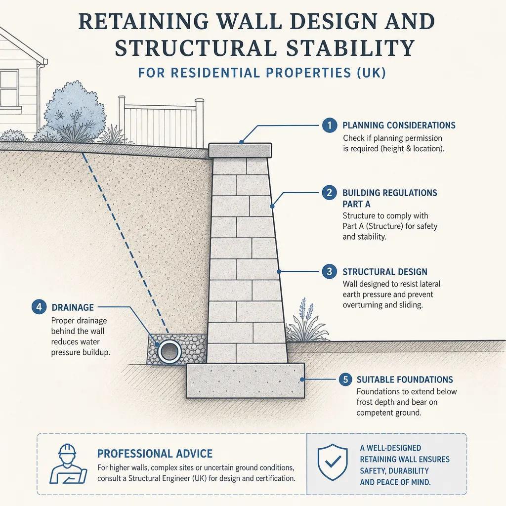
Retaining Wall Design and Structural Stability for Residential Properties
Retaining walls over around 1 m in height usually need structural engineer assessment; walls over 2 m almost always require a formal structural design and building control approval.
 Planning & Pre-Build
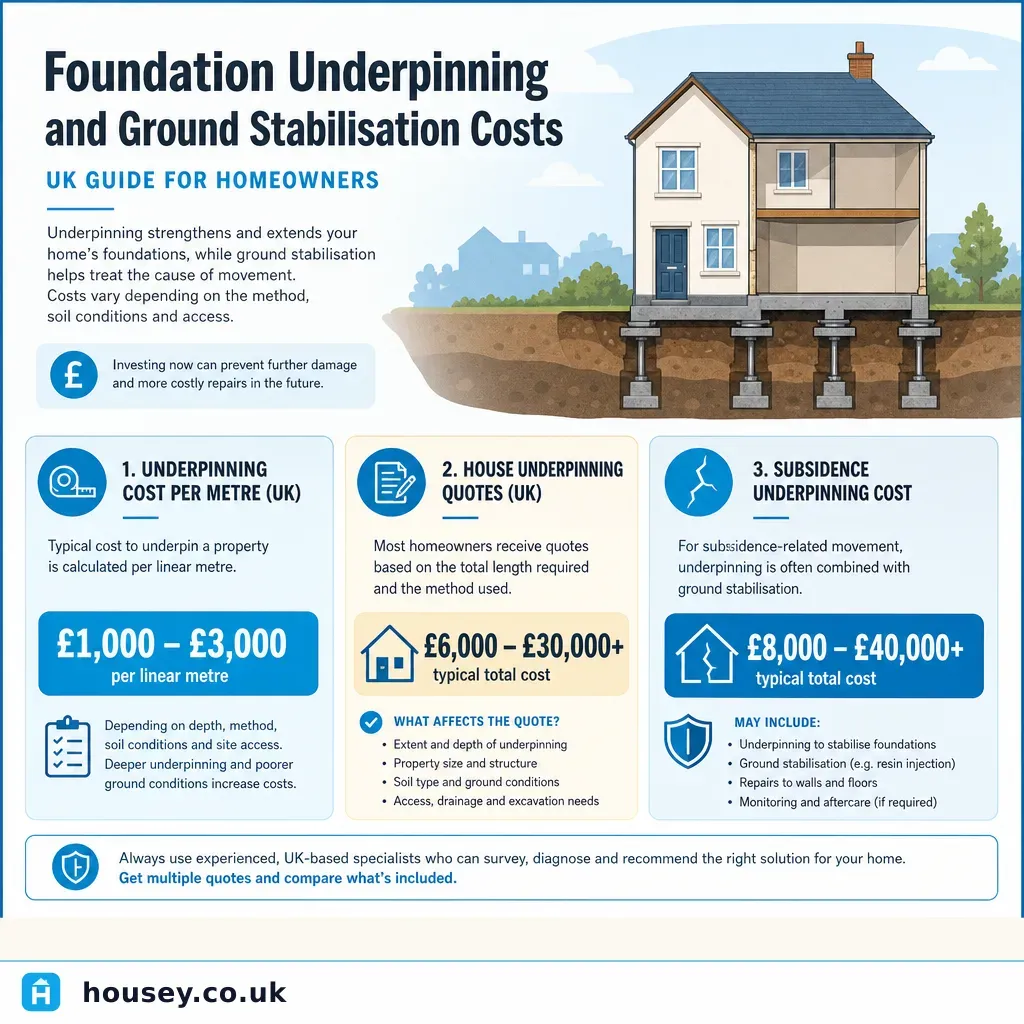
Foundation Underpinning and Ground Stabilisation Costs
Foundation underpinning in the UK typically costs £10,000–£50,000 or more for a whole property, with partial wall-section treatment running £5,000–£15,000.
 Planning & Pre-Build
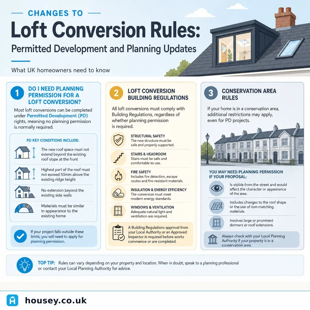
Changes to Loft Conversion Rules: Permitted Development and Planning Updates
In England, most loft conversions on standard houses qualify as Permitted Development under Class B of the GPDO 2015, allowing up to 40 cubic metres (terraced) or 50 cubic metres (detached or semi-detached) without a planning application — if conditions are met.
 Planning & Pre-Build
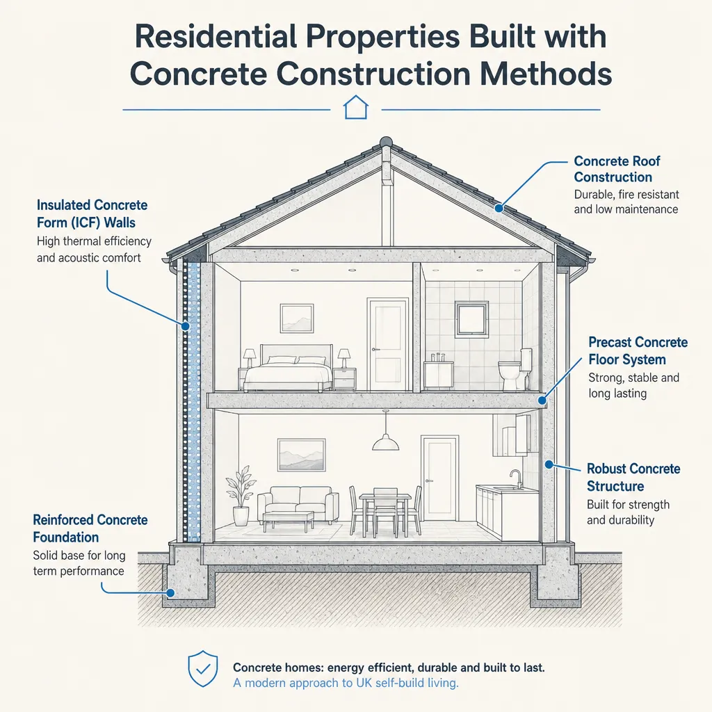
Residential Properties Built with Concrete Construction Methods
UK homes are built using several concrete methods: in-situ cast concrete, precast panel systems, insulating concrete formwork (ICF), and older non-traditional types such as Wimpey No-Fines and Laing Easiform.
 Planning & Pre-Build
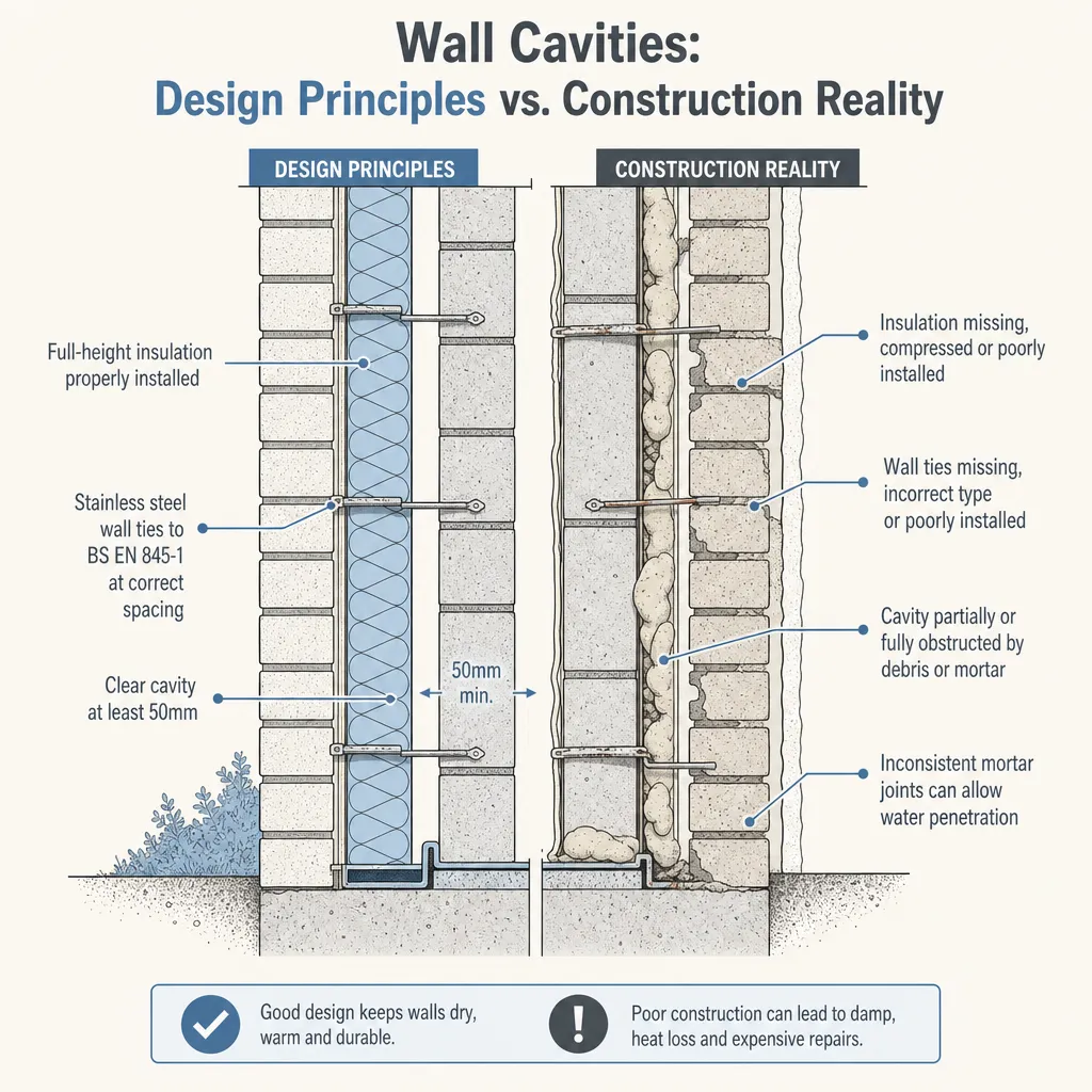
Wall Cavities: Design Principles vs. Construction Reality
A UK cavity wall is designed to resist weather, control heat loss, and structurally link two masonry leaves.